Indonesia's Geopark Decade: 12 UNESCO Sites Redrawing the Slow-Travel Map
While the argument about Bali's crowds has absorbed most of the attention paid to Indonesian tourism, a quieter piece of policy has been reorganising the archipelago's map. Indonesia now holds twelve UNESCO Global Geoparks, which places it third in the world by count, and the national development plan for 2025 to 2029 sets a target of seventeen. In 2026 no Indonesian site appeared in UNESCO's latest batch of new designations, but three existing geoparks came through their four-yearly review with their status intact. That combination, an expansion target plus a real review process, is turning the geopark label into something a slow traveller can actually use: a list of places where landscape, community tourism and public money have been pointed in roughly the same direction.
What a Geopark Actually Is
A UNESCO Global Geopark is not a national park and not a World Heritage site. It is a defined territory with geology of international significance, managed through a single body, where conservation is meant to sit alongside education and community-based economic development. Crucially, a geopark contains working towns and villages. People farm inside it, run guesthouses inside it, and quarry and fish inside it. The designation does not lock the landscape away; it asks the local administration to build tourism around the geology rather than in spite of it.
That has a practical consequence. Where a national park gives you a gate, a fee and a trail, a geopark gives you a region with interpretation panels, trained local guides, a visitor centre of variable quality, and a network of village-level operators who have usually had at least some training. It is a looser, messier and more interesting proposition, and it maps unusually well onto how slow travel actually works: a base, a week, and a landscape you learn in pieces.
The label is also audited. Every four years UNESCO revalidates each geopark and issues what the network informally calls a green card if management is satisfactory, a yellow card if there are two years of work to do, and ultimately delisting if a site fails to improve. This is not a plaque you hang on a wall and forget.
One request. Up to five tailored proposals.
Skip contacting agencies one by one — share your trip once and let up to five trusted Indonesia agencies come to you. Free, with no obligation.
Get my free quotesThe Twelve, and Where They Sit
Indonesia's twelve span almost the whole country. Batur in Bali was the first, designated in 2012, and remains the most visited. Gunung Sewu covers the limestone karst south of Yogyakarta into East Java. Ciletuh-Palabuhanratu sits on the West Java coast within reach of Jakarta. Rinjani-Lombok takes in the volcano and the villages around it. Toba Caldera in North Sumatra is the vast lake and Samosir island. Belitong covers the granite-boulder coast of Belitung. Merangin Jambi in Sumatra holds fossil flora in riverbed rock. Ijen in East Java is the sulphur crater and the acid lake. Maros-Pangkep in South Sulawesi is tower karst and prehistoric cave painting. Raja Ampat in West Papua is the reef archipelago. Kebumen in Central Java and Meratus in South Kalimantan are the two most recent additions.
Read that list again and notice what it does. Four of the twelve are in places most itineraries skip entirely, and two of them, Meratus in Kalimantan and Merangin in Jambi, are in provinces with almost no international leisure tourism at all. The geopark list is, in effect, a state-endorsed index of Indonesian regions that want visitors and have done some preparation for them. If you have been looking for a structured way to get beyond the standard circuit, our guide to travelling off the beaten path in Indonesia and this list overlap more than you would expect.
What Changed in 2026: Green Cards and Revalidation
The 2026 news came in two parts. First, UNESCO added twelve new Global Geoparks worldwide and none of them were Indonesian, which locally read as a disappointment after a strong run of designations. Second, and more consequential, three Indonesian geoparks, Rinjani-Lombok, Toba Caldera and Ciletuh-Palabuhanratu, passed revalidation and retained green card status.
That second result matters more than a new designation would have. Revalidation is where geoparks usually fail, because the initial bid is written by consultants and the four-year review looks at what was actually built: guide training, signage maintenance, community revenue share, waste management, quarry control. Three green cards in one cycle suggests the management bodies at Toba, Rinjani and Ciletuh are doing more than issuing press releases.
It also tells you something about where to spend your money. A recently revalidated geopark is a place where local guiding structures have just been inspected and found functional. That is a better signal of a decent visitor experience than a five-star average on a booking platform.
Get matched with up to 5 trusted Indonesia agencies
- Free
- No obligation
- Up to 5 agencies
The Geopark Run Series and the Sports-Tourism Turn
The most visible programme attached to the geopark network in 2026 is a running series scheduled from August 2026 through April 2027 across four geopark landscapes: Ijen in East Java, the Minangkabau highlands of West Sumatra, Ciletuh-Palabuhanratu in West Java and Belitong. The stated target is around ten thousand participants and visitors, with the explicit aim of spreading arrivals into the low season and into regional economies.
Treat this with measured interest rather than enthusiasm. Running events are a reasonable tool for filling shoulder-season beds in places with limited flight access, and they bring spending to homestays and warungs rather than to international hotel chains. They also concentrate hundreds of people into a single weekend in landscapes with thin infrastructure, which is precisely the pattern that damages fragile sites. If you are planning a quiet week in Ijen or on Belitung, check the event calendar first, for the same reason you would check a MotoGP weekend on Lombok.
Why This Matters for Slow Travellers
The geopark framework overlaps almost exactly with the model of travel we argue for. It is regional rather than site-based, which encourages staying put. It funds local guiding rather than imported expertise. It treats landscape as something to be explained rather than photographed. And because the designation covers inhabited territory, the money has a better chance of reaching the people who live there.
It also sits alongside the other Indonesian policy running in the same direction, the tourism-village programme, and the two frequently occupy the same ground. Several geoparks contain certified tourism villages, so the guide who walks you through a karst valley may be paid through one scheme and trained through another. Our analysis of Indonesia's tourism-village movement explains how that second system works and where it delivers.
The honest limitation is that a geopark designation says nothing about whether a place is pleasant to visit. It is a management award, not a quality rating. Batur is a UNESCO Global Geopark and also home to some of the most aggressive touting in Bali.
Where the Label Works: Three Honest Examples
Toba Caldera is the clearest success. The lake is the remnant of one of the largest volcanic eruptions in the last million years, and the geopark framing has given local operators a story to tell beyond swimming and guesthouse sunsets. Interpretation around the caldera rim and on Samosir has improved markedly, and the Batak cultural sites now sit inside a geological narrative rather than beside it. If you want the practical version of a week there, our regional piece on Lake Toba and Samosir covers the logistics.
Maros-Pangkep in South Sulawesi is the most underrated. The tower karst north of Makassar holds cave paintings among the oldest known figurative art anywhere, and the geopark has done real work on access and guiding. It remains a day trip for most visitors when it deserves four nights.
Merangin Jambi is the one almost nobody reaches. Its selling point is plant fossils embedded in riverbed rock, best seen from a boat on the Merangin river, and the infrastructure is genuinely basic. This is the geopark for travellers who want a region to themselves and are willing to accept limited English, few rooms and long road transfers.
Where the Label Does Not Work Yet
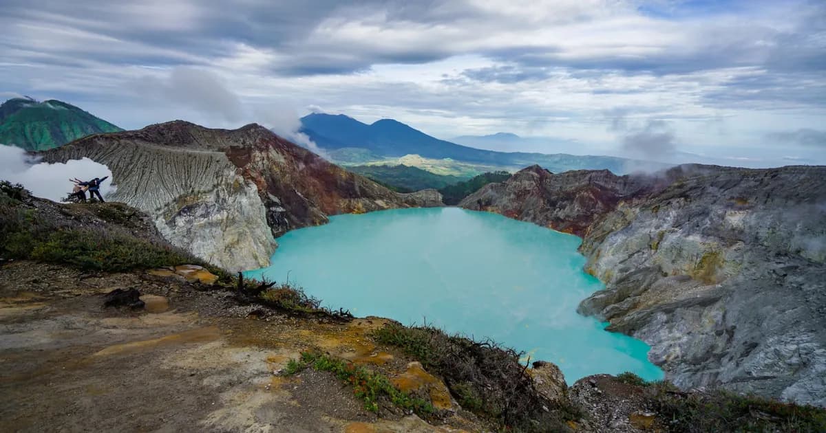
Ijen is the cautionary case. The geology is spectacular, the blue flames and the acid lake are world-class, and the visitor experience is largely organised around a two-in-the-morning convoy of jeeps delivering people to a crater rim for a photograph before dawn. Sulphur miners still carry loads up that path. The geopark designation has not yet reshaped the pattern, and the volume of pre-dawn traffic is the least geopark-like thing in the network. The slower approach is to base yourself in the coffee villages on the flank and walk in daylight, which our East Java route piece on Malang, Bromo and Ijen without the rush sets out in detail.
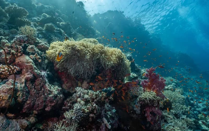
Raja Ampat faces a different problem. Its geology and biodiversity are beyond argument, but its visitor economics are tied to liveaboard diving and resort capacity, and the pressure there is about carrying limits rather than interpretation. A geopark designation is a weak instrument against a booking-driven growth curve.
And in the two newest geoparks, Kebumen and Meratus, there is simply not much for a visitor yet. Designation is the start of the work, not the end of it. Expect thin signage, few trained guides and almost no English for the next few years.
What to Watch Between Now and 2029
The seventeen-geopark target implies five more designations in four years, with Bojonegoro in East Java and the Silokek area of West Sumatra among the aspiring candidates. Watch three things. First, whether the new designations go to provinces with existing tourism or to places genuinely off the map, because that reveals whether the policy is about development or about marketing. Second, whether any Indonesian geopark receives a yellow card, which would be the first real test of whether the framework has teeth here. Third, whether community revenue share is published, because the difference between a geopark that works and a plaque on a district office is who receives the money.
For travellers, the practical read is simpler. Over the next few years the geopark list will keep pointing at regions that are investing in guides, interpretation and small-scale accommodation before the crowds arrive. That is a useful early-warning system in reverse: not where to avoid, but where to go while it is still quiet.
What to Do Next
- Pull up the current list of Indonesia's twelve geoparks and cross it against the islands you were already considering, rather than treating it as a separate itinerary.
- Prioritise a recently revalidated site if this is your first geopark trip, because guiding and interpretation there have just been inspected.
- Check the geopark run series dates against your travel window if you are heading for Ijen, Belitong, Ciletuh or West Sumatra between August 2026 and April 2027.
- Book local guides through the geopark visitor centre or a village cooperative rather than an aggregator, so the fee stays in the district.
- Give each geopark a minimum of four nights; these are regions, not viewpoints, and a day trip gets you the photograph and nothing else.
- If you would rather build a trip around this principle than around a checklist, read our charter for slow travel and start from there.
Frequently Asked Questions
How many UNESCO Global Geoparks does Indonesia have?
Twelve, following the addition of Kebumen in Central Java and Meratus in South Kalimantan. That places Indonesia third in the world by number of geoparks, and the national plan targets seventeen by 2029.
Is a geopark the same as a national park in Indonesia?
No. A national park is a protected conservation area with gates and entrance fees. A geopark is a managed territory that includes towns, farms and businesses, where the geology is the organising theme for conservation, education and local tourism. Some geoparks overlap with national parks, but the two regimes and the two fee systems are separate.
Do I pay an extra fee to enter a geopark?
Generally no. You pay the normal site fees inside it, for a waterfall, a cave, a crater or a national park section, and those are unchanged by the geopark designation. Some visitor centres charge a small admission.
Which Indonesian geopark is best for a first visit?
Toba Caldera is the easiest to travel and the strongest on interpretation, with good road access from Medan and plenty of accommodation on Samosir. Gunung Sewu is the most convenient if you are already in Yogyakarta. Maros-Pangkep is the best value for effort if you want somewhere quieter.
What does a green card mean for a geopark?
It means the site passed its four-yearly UNESCO revalidation with management judged satisfactory. In 2026 Rinjani-Lombok, Toba Caldera and Ciletuh-Palabuhanratu all retained green card status. A yellow card would give a geopark two years to fix identified problems before facing removal from the network.
Are the newest geoparks worth visiting now?
Kebumen and Meratus are worth a look only if you actively enjoy being early. Guiding, signage and English-language interpretation in newly designated Indonesian geoparks typically take several years to develop, and accommodation is limited to simple local options.
Does the geopark label actually reduce overtourism?
Not by itself. It spreads attention towards regions that would otherwise receive none, which helps, but it has no power to cap arrivals. Where visitor numbers are the core problem, as at Raja Ampat, permits and carrying caps do the work and the geopark designation is largely symbolic.
Keep reading
More from the ground · Indonesia