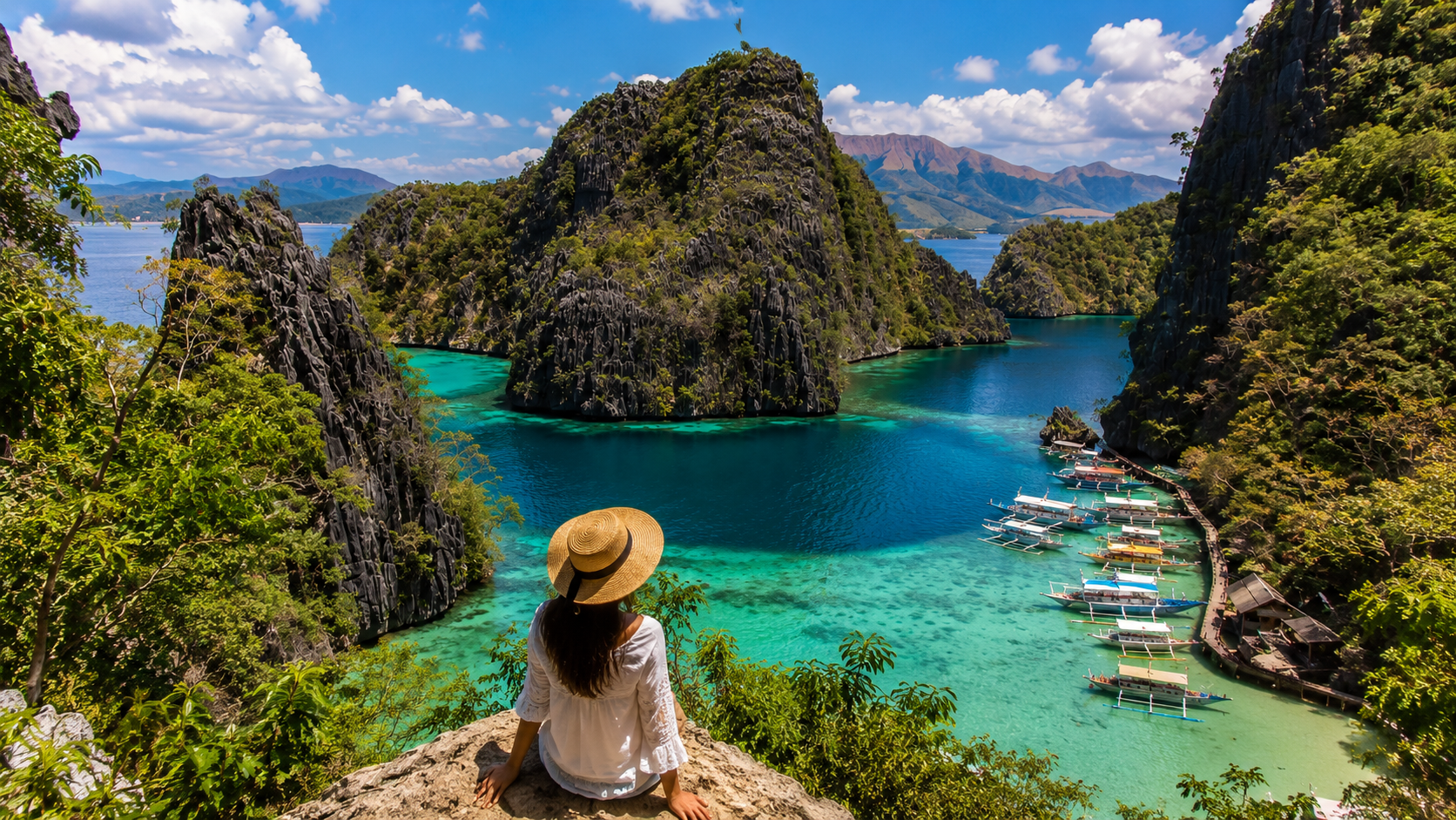

The Philippines has 7,641 islands. Most visitors see about five of them.
That is not a criticism. Boracay, El Nido, Coron, Cebu and Siargao are famous for reasons that hold up: the water really is that colour, the limestone really does rise out of the sea like something drawn from memory. But when a country of that size funnels almost all of its international arrivals into a handful of postcards, two things happen. The postcards get crowded, and everything else stays quiet.
This guide is about everything else. It is not a list of "secret" places, because almost nothing in the Philippines is genuinely secret — Filipinos have been holidaying on these islands for generations, and the fishing village you think you discovered has a barangay hall, a basketball court and a Facebook page. What these places are is uncrowded, and that is a different and better thing. Uncrowded means you can sit on a pier at six in the morning without anyone selling you anything. It means a boat leaves when it leaves. It means the person who cooks your breakfast is the person who caught it.
It also means friction. Getting to Batanes costs more than getting to Bali. Getting to Marinduque takes a bus, a ferry and patience. Some crossings simply do not happen when the wind is up, and no amount of planning changes that. If you want a country to unfold slowly rather than perform on schedule, that friction is the price and, honestly, the point.
Why go further in a country where visitors cluster in five places
Look at a map of Philippine tourism and you see a strange shape: a country spread across 1,850 kilometres of ocean, with visitors concentrated in perhaps two percent of it. The reason is structural rather than mysterious. International flights land in Manila and Cebu. Budget carriers connect those hubs to a short list of resort airports. Everything else requires a second flight, a bus, a ferry, or all three — and most people travelling on two or three weeks of annual leave, quite reasonably, do not want to spend four of those days in transit.
Slow travel changes that arithmetic. If you are giving a country three weeks instead of nine days, the ferry stops being a loss and becomes part of the trip. And the payoff is disproportionate. In Romblon you will be the only foreigner on the boat. In Biri you will walk across a rock formation the size of a cathedral with nobody in it. In Batanes you will find yourself in a landscape that looks nothing like the Philippines you were sold — no palms, no white sand, just green hills falling into a violent grey sea, and stone houses built to survive typhoons.
There is a practical argument too. Costs drop sharply outside the resort corridors. A room that runs 6,000 pesos a night in El Nido runs 1,500 in Port Barton, and 900 in Romblon town. Our guide to Philippines trip costs and budgets breaks down what the quieter islands actually cost once you account for the extra flights and boat transfers, which do eat into the savings but rarely erase them.
And there is an ethical argument, which we will come back to. Tourism revenue in the Philippines is extraordinarily concentrated. Spreading it — carefully, and with respect for places that have not built the infrastructure to absorb crowds — is one of the few genuinely useful things a traveller can do.
One request. Up to five tailored proposals.
Skip contacting agencies one by one — share your trip once and let up to five trusted Philippines agencies come to you. Free, with no obligation.
Get my free quotesThe far north: Batanes and the Ivatan islands
Batanes is the smallest and northernmost province of the Philippines, closer to Taiwan than to Manila, and it does not look or feel like the rest of the country. There are no white-sand beaches to speak of. What there is instead: rolling grass hills grazed by cattle, cliffs dropping straight into the Bashi Channel, lighthouses, and the stone-and-thatch houses of the Ivatan people, built with metre-thick limestone walls and cogon roofs lashed down to survive the typhoons that cross this stretch of ocean every year.
The islands are Batan (where the capital, Basco, sits), Sabtang and Itbayat. Batan is the one most visitors see, and it is small enough to circle by bicycle or scooter in a long day — Marlboro Country's grassland ridges, Chawa cave, the old Spanish-era church at Ivana, the Racuh a Payaman viewpoint. Sabtang is reached by faluwa, a round-bottomed wooden boat with no outriggers, roughly a 30 to 45 minute crossing that is cancelled outright when the swell is wrong. Sabtang is where the stone villages of Savidug and Chavayan are best preserved, and where the vakul — a headdress woven from abaca fibre that sheds rain and sun — is still worn in the fields rather than for photographs.
Itbayat is harder. The crossing takes three to four hours in open water on a cargo-passenger boat, and it is frequently cancelled for days at a stretch. There is an airstrip served by small aircraft, but flights are irregular. Do not plan Itbayat with a tight onward connection.
Access, honestly. Basco has a small airport served from Manila, with Philippine Airlines and Cebu Pacific operating the route on turboprops; flight time is under two hours and fares are among the highest domestic fares in the country, often several times the cost of a Manila–Cebu ticket. Flights are weather-sensitive and cancellations are routine, especially between July and October. Build a buffer day at each end. There is no ferry from Luzon that any traveller should attempt.
When to go. March to May is the driest and calmest window, and also when the hills are greenest after the northeast monsoon. June to October is typhoon season and genuinely disruptive. November to February brings the amihan — cool, windy, dramatic, and hard on boat crossings.
How to behave. Batanes is famous domestically for its honesty stores: unmanned roadside stalls where you take a drink and leave the money. This is not a tourist gimmick, it is a functioning social norm, and it survives because people do not abuse it. Treat it accordingly.
The Cordillera highlands: Sagada, Batad and Kalinga
Northern Luzon's mountain interior is the one part of the Philippines that is not about the sea at all. It is cold at night, wrapped in pine and cloud, and it holds the country's most significant living cultural landscapes.
Sagada, in Mountain Province, is the best-known stop and still nothing like a resort town. It sits at around 1,500 metres, reached by a winding road from Bontoc or Baguio. The draw is the limestone: Sumaguing and Lumiang caves, connected by a strenuous four-hour "cave connection" traverse that involves genuine scrambling and rope work; the Echo Valley hanging coffins, where Igorot dead were traditionally interred on cliff faces rather than in the ground; and the Bomod-ok falls, reached through terraced rice fields. Sagada has become popular with Filipino travellers, particularly on long weekends and around Christmas and Holy Week — go midweek and outside those windows and it is calm.
The hanging coffins deserve a word. They are a burial site, still culturally live, not a photo backdrop. Guides are mandatory for a reason. Do not touch them, do not climb toward them, and do not treat the valley as a set.
Banaue and Batad, in Ifugao, hold the rice terraces that most people picture when they picture the Philippines — though the UNESCO listing actually covers five specific cluster sites, and Banaue's famous viewpoint terraces are not among them. Batad is the one to walk into. The village sits in a natural amphitheatre of stone-walled terraces, and until recently could only be reached on foot from a road junction called the saddle; a road now runs closer, but the last stretch is still a walk down and, on the way out, a hard climb up. Stay overnight. The terraces at dawn, with mist sitting in the bowl and nobody else on the paths, are worth the knees. Nearby Bangaan and the hot springs and terraces around Hapao and Hungduan see a fraction of Batad's visitors.
Kalinga and Buscalan are further north and further in. Buscalan is a small Butbut Kalinga village, reached by a long drive from Bontoc or Tabuk followed by a trek in — historically over an hour on a mountain path, though a cable-tram now shortens it for those who need it. It has become internationally known because of Apo Whang-od, a mambabatok — traditional hand-tap tattooist — now well past 100 years old, who tattoos with a thorn, a bamboo stick and soot ink.
We will deal with the ethics of that below, because they are not simple. Practically: you need a local guide, homestays are basic, there is no reliable phone signal, there are no ATMs, and the village now receives more visitors in a week than it once did in a year. Reputable operators require booking well ahead. Go for the village, the terraces and the tattoo tradition as a whole rather than for a single elderly woman's hands, and you will have a better and less extractive time.
Get matched with up to 5 trusted Philippines agencies
- Free
- No obligation
- Up to 5 agencies
Quieter Palawan: Port Barton, the north coast and Balabac
Palawan is not one destination. El Nido and Coron absorb most of the traffic, and both are genuinely spectacular and genuinely busy — El Nido's Bacuit Bay in high season can see hundreds of boats running four numbered tour routes. The rest of the island is nearly empty.
Port Barton, on the west coast between Puerto Princesa and El Nido, is the obvious first step. It is a single-street beach village with limited grid electricity historically, a bay dotted with small islands, and boat trips that visit turtles, reefs and sandbars at a fraction of El Nido's price and crowding. It has grown, and it is no longer undiscovered, but it remains the version of Palawan that El Nido was fifteen years ago. Reach it by van from Puerto Princesa (about four hours) or from El Nido (about three).
San Vicente, just north, has Long Beach — at roughly 14 kilometres, one of the longest white-sand beaches in the country, and usually close to deserted. There is an airport there with intermittent service. Sibaltan and the northeast coast around El Nido municipality offer a different, calmer side of the same peninsula.
Balabac, at Palawan's southern tip, is the genuinely remote option: a scatter of sandbars and islands with water that looks digitally enhanced, reached by a long land transfer from Puerto Princesa (six to eight hours to Rio Tuba) and then a boat crossing. Infrastructure is minimal, trips are usually multi-day camping-style tours run by local operators, and crossings depend entirely on sea conditions. It also sits close enough to the southwestern maritime border that some governments' travel advice touches the area — check current guidance before committing.
If you are trying to work out how these fit into a season, our slow traveller's guide to where to go and when in the Philippines maps the country's split monsoon patterns, which matter enormously here: the archipelago does not have a single dry season, and the east coast and west coast are often in opposite weather at the same time.
The overlooked Visayas: Siquijor, Romblon, Marinduque, Bantayan, Malapascua and Apo
The central Visayas is where the Philippines feels most like an archipelago — dozens of inhabited islands within ferry reach of each other, most of them quiet.
Siquijor carries a reputation within the Philippines as an island of folk healers and mananambal, which for years kept domestic visitors slightly wary of it and kept it undeveloped. It is now firmly on the backpacker map but still small and manageable: Cambugahay falls, the old Lazi convent, the century-old balete tree, empty stretches of coast at Paliton and San Juan, and good, cheap diving. Reach it by fast ferry from Dumaguete (about an hour) or Bohol.
Apo Island, off Negros near Dauin, is one of the oldest community-managed marine sanctuaries in Asia — protected since the 1980s by the islanders themselves. It is a day trip from Dumaguete or Dauin, or an overnight in very simple accommodation. The green turtles in the seagrass are essentially reliable. Snorkellers should stay off the coral and out of the sanctuary's no-take zone unless with a guide; the reef's recovery is the whole reason the island is worth visiting.
Romblon province is three main islands — Romblon, Tablas and Sibuyan — and remains one of the least-visited provinces in the country. Romblon town is a marble-quarrying port with Spanish fortifications and workshops carving stone the way they have for a century. Sibuyan is the extraordinary one: an island that has never been connected to any landmass, with Mount Guiting-Guiting rising 2,058 metres out of the sea and one of the densest recorded forests on earth. The Guiting-Guiting traverse is a serious multi-day climb with permits and mandatory guides, not a casual hike. Access is by ferry from Batangas (overnight), from Mindoro, or by flying to Tugdan on Tablas and connecting by land and boat.
Marinduque, a heart-shaped island in the Sibuyan Sea, has no scheduled commercial flights despite having an airstrip. You reach it by bus from Manila to Lucena (four to five hours) and then RoRo ferry (three to four hours) to Balanacan or Cawit. It is best known for the Moriones Festival at Easter, when masked figures representing the Roman centurion Longinus fill the streets of Boac and Mogpog — one of the country's most striking folk-Catholic traditions. Outside Holy Week it is almost entirely undisturbed: hot springs at Malbog, the Bathala caves, and the Tres Reyes islets offshore.
Bantayan Island, off northwest Cebu, is flat, sandy, bicycle-friendly and completely different in character from the diving islands. Santa Fe's beaches are genuinely beautiful and the island empties out midweek. Malapascua, off Cebu's northern tip, is a diving destination built around one thing: the pelagic thresher sharks that come to seamount cleaning stations at dawn. Note that the sharks largely shifted from Monad Shoal to nearby Kimud Shoal in recent years, so operators now run early-morning dives there; the 4am boat departure has not changed. Both islands took the full force of Typhoon Haiyan in 2013 and have rebuilt.
Samar and Biri: rock, caves and the Sohoton river
Samar is a large, wet, thinly-touristed island in the eastern Visayas, and it is one of the most underrated landscapes in the country. It is also karst — riddled with caves, sinkholes and underground rivers, much of it barely surveyed.
Biri Island, off Samar's northern tip, has the rock formations: six named outcrops of layered sandstone — Magasang, Magsapad, Caranas, Bel-at, Puhunan and Macadlaw — sculpted by the meeting of the Pacific and the San Bernardino Strait into terraces, tide pools and sheer walls. At low tide you can walk between several of them. At high tide, or when the swell is up, you cannot, and the boatmen will tell you so. Getting there means reaching Lavezares in Northern Samar (bus from Manila is a long haul; more commonly you fly to Catarman or Calbayog) and then a small boat crossing of around 45 minutes to an hour. Accommodation on Biri is simple guesthouses.
Sohoton Natural Bridge National Park, near Basey in Western Samar and usually accessed from Tacloban, is a river caving and boating trip: a jade-green river, a natural limestone arch, and caves with formations that require a guide and a lamp. Trips are arranged through the tourism office in Basey and depend on water levels — after heavy rain the river runs too high and trips are suspended.
Further south and east, Calbiga caves form one of the largest cave systems in Southeast Asia and are visited by very few people; Marabut's rock islets and Borongan's surf coast in Eastern Samar are similarly empty. This is genuinely undeveloped travel: expect basic rooms, limited English in smaller towns, and real dependence on local guides. Samar also sits directly in the typhoon corridor, so November to January is the wrong time.
Caramoan and the Bicol coast
The Caramoan peninsula in Camarines Sur is the Philippine landscape most people assume is Palawan: limestone karst islets, hidden coves, white sand. It became known internationally because multiple foreign editions of the television series Survivor filmed there for years, which brought infrastructure but oddly little independent tourism.
Access is the reason. From Naga (which has an airport with Manila flights) you travel by land to Sabang, then take a boat across Lagonoy Gulf to Guijalo — roughly two hours, and cancelled in rough weather. There is a longer all-land route via Sagñay. Once there, the island-hopping among Matukad, Lahos, Cotivas and Manlawi is superb and rarely crowded outside Philippine holidays. The best window is March to May; the Bicol region is one of the most typhoon-exposed parts of the country from July onward.
Bicol rewards a slower loop. Mayon volcano's near-perfect cone above Legazpi, the whale sharks of Donsol (a genuinely well-managed, swim-only, no-touching operation from roughly December to May, unlike the controversial provisioned feeding elsewhere in the country), and some of the best food in the archipelago — coconut milk and chilli in everything. If you are eating your way around, our guide to Filipino food and what to eat covers the regional dishes worth crossing an island for.
Mindanao's accessible gems: Camiguin, Siargao's quiet side, Dinagat and Davao
Mindanao requires an honest paragraph rather than either enthusiasm or alarm.
Several Western governments maintain standing travel advisories for parts of Mindanao. The UK's FCDO, for example, advises against all travel to western and central Mindanao and the Sulu archipelago, and against all but essential travel to the remainder of Mindanao — with explicit exceptions for Camiguin, Dinagat and Siargao. The US State Department applies elevated advisory levels across the island group. These advisories are driven by long-running insurgency and kidnapping risk in specific western and central areas, not by conditions in Davao City or the northeastern islands, which millions of Filipinos and a steady stream of foreign visitors move through without incident.
Two things follow from that, and both matter. First: check your own government's current advice before you book, because it changes and because travelling against it can invalidate your travel insurance — that is the practical consequence, and it is not trivial. Second: do not let a blanket advisory over an island the size of Portugal convince you that Camiguin is dangerous. It is not.
Camiguin is a small volcanic island off northern Mindanao with seven volcanoes on 238 square kilometres, reached by ferry from Balingoan near Cagayan de Oro (about an hour) or by flights from Cebu to Mambajao. It has hot springs and cold springs, waterfalls, a sunken cemetery marked by a cross in the sea after an 1871 eruption, and the White Island sandbar offshore. It is one of the most quietly likeable islands in the Philippines and very easy to travel.
Siargao is well known for Cloud 9 and General Luna, which are now busy. Its quiet side is not: the northern part of the island around Pilar and Burgos, the Magpupungko rock pools at low tide, the mangrove channels at Del Carmen, and above all the outer islands. Bucas Grande and the Sohoton Cove system — a different Sohoton from Samar's — has stingless jellyfish lagoons entered through a cave mouth that is only passable at certain tides, and access is regulated. Further out, the Britania islands off Surigao del Sur and the coast around Cantilan see very few foreign visitors.
Dinagat Islands, north of Siargao, is one of the newest and least-visited provinces: rugged, mineral-rich, with unusual bonsai forest on ultramafic soils and a distinct religious history. Boats run from Surigao City.
Davao City is Mindanao's largest urban centre and, by domestic reputation, one of the more orderly cities in the country. It is the gateway to Mount Apo, the Philippines' highest peak at 2,954 metres, a multi-day climb requiring permits and guides, and to the Philippine Eagle Center, which runs the conservation breeding programme for a critically endangered bird with perhaps a few hundred pairs left in the wild. Advisory caveats apply as above.
Tubbataha: the reef you cannot casually visit
Tubbataha Reefs Natural Park, in the middle of the Sulu Sea, is a UNESCO World Heritage site and one of the last genuinely intact reef systems in Southeast Asia — no human population, no fishing, no coastal runoff. It is reachable only by liveaboard from Puerto Princesa, and only during a narrow season, roughly mid-March to mid-June, when the Sulu Sea is calm enough to cross. The crossing itself takes ten to twelve hours.
Trips run six to seven days, cost several thousand US dollars, require a park permit administered through the management board (normally arranged by the boat), and sell out far in advance — six to twelve months is standard, longer for peak April and May departures. Divers should be comfortable in current and have a reasonable number of logged dives; most operators set a minimum. There is no day-trip version and no snorkelling-only version worth the money. If you want it, plan a year out.
Sample off-beat routes
Two weeks, northern Luzon. Manila → Batanes (four nights, with a buffer day) → back to Manila → overnight bus to Banaue → Batad (two nights, walking) → Bontoc → Sagada (three nights) → Buscalan or Kalinga side trip if pre-arranged → Baguio → Manila. Cool, cultural, almost no beach. Best March to May.
Three weeks, the quiet Visayas. Cebu → Bantayan (three nights) → Malapascua (three nights, diving) → ferry and land to Dumaguete → Apo Island and Dauin (three nights) → Siquijor (four nights) → Bohol's interior rather than Panglao → Cebu. All ferry-connected, minimal flying, very manageable.
Three weeks, the eastern edge. Manila → Catarman → Biri (three nights) → Calbayog → Tacloban → Sohoton and Marabut (three nights) → ferry to Surigao → Siargao's north and Bucas Grande (five nights) → ferry to Camiguin (four nights) → Cagayan de Oro → home. Wet, wild, empty. Avoid November to January.
Two weeks, slow Palawan. Puerto Princesa → Port Barton (five nights) → San Vicente (two nights) → El Nido briefly, using Sibaltan or the mainland rather than the town → back south. Or, if the dates align, swap all of it for a Tubbataha liveaboard in April.
Three weeks, island province sampler. Manila → Lucena → Marinduque (five nights) → ferry to Romblon → Tablas and Romblon town (four nights) → Sibuyan (four nights) → ferry to Mindoro or back to Batangas. This is the hardest to schedule and the most rewarding if the ferries cooperate.
If you would rather not assemble any of this yourself, planning your journey with a vetted local specialist is usually the difference between a route that works and one that collapses on the third missed boat.
Travelling responsibly in places that are not built for crowds
Indigenous communities. The Cordillera is home to Igorot peoples — Ifugao, Kankanaey, Bontoc, Kalinga and others — with distinct languages, land rights and customary law. In practice this means: hire local guides, because in many areas it is required and in all areas it is the mechanism by which your money stays local; ask before photographing people, especially elders; observe tengao or ubaya, community rest days when outsiders may be asked not to enter or to refrain from certain activities; and do not walk unaccompanied on terrace walls, which are private agricultural property maintained by hand.
The ethics of tattoo tourism in Buscalan. This is the hardest one. Batok was a warrior and womanhood tradition that had nearly died out; international attention around Apo Whang-od has unquestionably revived interest, brought income to a village that had very little, and created a generation of younger practitioners including her grand-nieces who are continuing the practice. That is a real good. But the village now handles volumes it was never designed for — waste, water and sanitation are under strain — and there are legitimate ongoing debates locally about queue systems, the use of modern equipment alongside hand-tap work, and the pressure on a woman well over a hundred years old to perform daily. There is no formal regulation of much of this.
A defensible way to go: book through operators who work directly with Buscalan households rather than intermediaries, pay the community fees without haggling, stay at least one night rather than treating it as a drive-by, accept a tattoo from any of the mambabatok rather than insisting on one specific pair of hands, carry your rubbish out, and be prepared to be told no. If the only reason you are going is a photograph with a specific person, consider not going.
Reefs. Do not touch coral, do not stand on it, do not chase turtles or reef sharks, and use mineral sunscreen or, better, a rash guard. Apo Island and Tubbataha are protected because communities and park authorities fought for them; the fees you pay are the enforcement budget. Decline any operator who offers to feed marine life to guarantee sightings.
Money. Outside the main destinations, cash is the only option — ATMs are scarce on Biri, Sibuyan, Marinduque, Buscalan and much of Batanes, and card acceptance is close to zero. Draw enough before you go and carry small notes. Buy from sari-sari stores and local carinderias. Our charter for slow travel sets out the principles we apply to every itinerary and every agency we work with, and most of them come down to the same idea: fewer places, longer stays, more money reaching the people who live there.
Logistics, timing and local help
Flights. The domestic network is genuinely good and genuinely cheap, but it is hub-and-spoke through Manila and Cebu. Sideways connections often do not exist. Two same-day domestic connections through Manila is a gamble; through Cebu it is safer. Always book the first flight of the day out of a weather-exposed airport.
Ferries. Fast craft, RoRo and bangka outriggers all operate on published schedules that are advisory rather than binding. Small boats do not sail in heavy swell, and that is a good thing. Assume one lost day per week of island-hopping and you will never be angry.
Weather. The archipelago has two monsoons and no single dry season. Broadly, the western seaboard — Palawan, Boracay, western Visayas — is driest from roughly December to May, while the eastern seaboard — Samar, Leyte, Siargao, Bicol — gets its calmest weather around March to June and its worst from November to January. Typhoon season runs roughly June to November with a northern bias, and Batanes, Bicol and eastern Samar are the most exposed. None of this is a reason not to go; it is a reason to sequence your route with the weather rather than against it.
Language and connectivity. English is widely spoken, and more so in tourism than in remote barangays. Buy a local SIM at the airport. Signal is decent on most inhabited islands and absent in Buscalan, parts of Sibuyan and stretches of Samar.
Local help. For the harder destinations — Samar caving, Sibuyan, Balabac, Kalinga, multi-island ferry chains — a good local operator is not a luxury. They know which boat actually runs, which homestay has water, and who to call when the crossing is cancelled. Our directory of vetted Philippines travel agencies lists specialists we have assessed on exactly that basis.
The reward of going further
The argument for the quieter Philippines is not that the famous places are ruined. It is that the country is much larger and stranger than its highlight reel suggests, and that the extra day of travel buys you something that cannot be bought any other way: the experience of arriving somewhere that is not expecting you.
It looks like this. A stone house in Sabtang with the wind coming off the channel and an Ivatan grandmother explaining, without ceremony, why the roof is built that way. A pre-dawn walk down into Batad when the mist is still in the terraces. A boat pulling into Biri with six people on it. The moment a thresher shark comes up out of the blue at Kimud and everyone forgets to breathe. Coffee in Sagada while the cloud lifts off the pines.
None of it is exclusive, and none of it is difficult in any heroic sense. It just requires that you stop optimising. Take the longer route, book fewer places, leave the buffer day, and let the ferry schedule make some of your decisions for you. The Philippines is very good at rewarding people who are not in a hurry.
Frequently Asked Questions
Is it safe to travel off the beaten path in the Philippines?
For the great majority of the destinations in this guide, yes, with normal precautions. The Philippines' quieter islands are generally very safe for travellers; the more realistic risks are road accidents, sea conditions and medical facilities being far away rather than crime. The important exception is Mindanao, where several Western governments maintain advisories against travel to western and central areas and the Sulu archipelago — while explicitly excepting Camiguin, Dinagat and Siargao. Check your own government's current advice before booking, because travelling against it can invalidate travel insurance.
How much extra time do I need for the lesser-visited islands?
Plan roughly one to two extra days per remote destination compared with a resort itinerary, plus one buffer day per week overall. Batanes needs a buffer day at each end because flights are frequently cancelled. Marinduque, Romblon, Biri and Sibuyan all involve ferry legs that can be delayed. If your route has no slack in it, a single missed boat cascades through the whole trip.
When is the best time to visit the off-beat Philippines?
March to May is the most reliable window nationwide: it is the calmest period for Batanes and Caramoan, the driest for Palawan and the eastern Visayas, and it covers the entire Tubbataha liveaboard season. December to February suits western Palawan and the central Visayas but brings strong northeast winds that disrupt northern crossings. June to November is typhoon season, with the north and east most exposed.
Is Batanes worth the cost of getting there?
If you have three weeks and an interest in landscape and culture rather than beaches, yes. If you have ten days and want to swim, spend the money elsewhere. Batanes is expensive by Philippine standards — flights from Manila often cost several times a Manila–Cebu ticket — and the weather can take days off your trip. What you get in return is unlike anywhere else in the country: Ivatan stone architecture, cliff-and-grassland scenery and an unusually intact community life.
Can I visit Whang-od in Buscalan, and should I?
You can, through a local guide, and it requires a long drive from Bontoc or Tabuk plus a trek or cable-tram into the village. Whether you should depends on how you go. The village is under real strain from visitor numbers, and there is active local debate about how the practice should be managed. Going respectfully — booking through operators tied to Buscalan households, staying overnight, accepting work from any of the mambabatok rather than one specific elder, and carrying your waste out — is defensible. Treating it as a checklist photo opportunity is not.
Which off-beat islands are easiest for a first-time visitor?
Siquijor, Camiguin, Bantayan and Port Barton are the gentle entry points: all have straightforward transport, a decent range of accommodation, and no unusual logistics. Sagada and Batad are easy culturally but involve long mountain road journeys. Save Biri, Sibuyan, Balabac and Marinduque for a second trip or for travellers comfortable with basic rooms, cash-only economies and schedules that move.
Do I need to book Tubbataha in advance?
Yes, well in advance. The season is only around three months long, mid-March to mid-June, access is by liveaboard from Puerto Princesa only, and berths are limited. Six to twelve months ahead is standard and popular April and May departures can go earlier than that. Park permits are administered by the management board and are normally arranged by the boat operator as part of the package.