
Vietnam's far northeast asks for something most travellers no longer offer: patience. Cao Bang sits roughly 280 kilometres north of Hanoi, a full day of winding mountain road away from the coastal circuit most visitors follow. There is no airport, no bullet train, no shortcut. What waits at the end of the drive is a province of limestone towers, jade-green rivers, terraced valleys and stone-built villages where the Tay and Nung peoples have farmed for centuries. This is not a place to tick off in an afternoon. It is a place to slow down inside.
Much of the province falls within the Non Nuoc Cao Bang UNESCO Global Geopark, recognised in 2018 and, in 2026, revalidated by UNESCO with its highest "Green Card" rating at a ceremony in Paris. The geopark spans more than 3,000 square kilometres and protects rock formations dating back over 500 million years. But the label matters less than what it protects: an intact cultural landscape where geology, water and daily life are still braided together. For a fuller picture of the country's shift toward this kind of unhurried travel, our ultimate slow-travel guide to Vietnam sets the wider context.
Why Cao Bang rewards the slow traveller
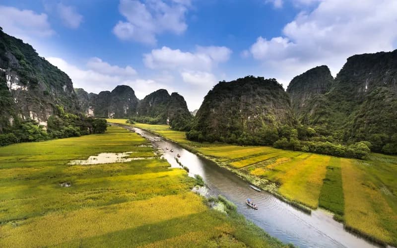
Cao Bang is not a single attraction with a car park. It is a region best understood as a landscape you move through rather than a box you photograph. The distances are real, the roads are slow by design, and the payoff is a rhythm that has all but vanished from Vietnam's busier destinations.
The province was long overlooked precisely because it is hard to reach. That difficulty has protected it. You will not find the crowds of Sa Pa or the tour-bus choreography of Ha Long here. Instead you get quiet passes, roadside tea stops, water buffalo on the tarmac, and villages where a homestay dinner is cooked over an open fire because that is simply how dinner is cooked.
Slow travel here is not a marketing pose. It is the only sensible way to experience a place where the best moments happen between the sights: a market morning in a valley town, a conversation with a Nung incense-maker, an hour spent watching the light move across a rice terrace.
One request. Up to five tailored proposals.
Skip contacting agencies one by one — share your trip once and let up to five trusted Vietnam agencies come to you. Free, with no obligation.
Get my free quotesThe Non Nuoc Cao Bang Geopark and its four routes
The geopark authority has organised the province into four signposted experiential routes, and understanding them is the key to planning a trip that is not just a checklist. Each route has a theme and a direction, and each can absorb one to two unhurried days.
- The eastern route, "Experiencing Indigenous Culture in a Fairytale Land," is the most famous. It gathers Ban Gioc Waterfall, Nguom Ngao Cave and the mirror-still Thang Hen Lake, threaded through Tay and Nung country.
- The western route, "Exploring Phia Oac," climbs into cloud forest and the cool highlands around Phia Oac-Phia Den National Park, where French-era ruins and tungsten mines sit among azaleas and mist.
- The northern route, "Journey to the Origins," leads to Pac Bo, the cave and stream where Ho Chi Minh returned to Vietnam in 1941, a quiet, historically weighty corner.
- The southern route, "A Time of Fiery Flowers," traces the province's revolutionary history through its lesser-visited southern districts.
You do not need to attempt all four. A calm, rewarding trip might pair the eastern route with a slow day on the western one, leaving the north and south for a return visit.
Ban Gioc Waterfall, on the edge of two countries
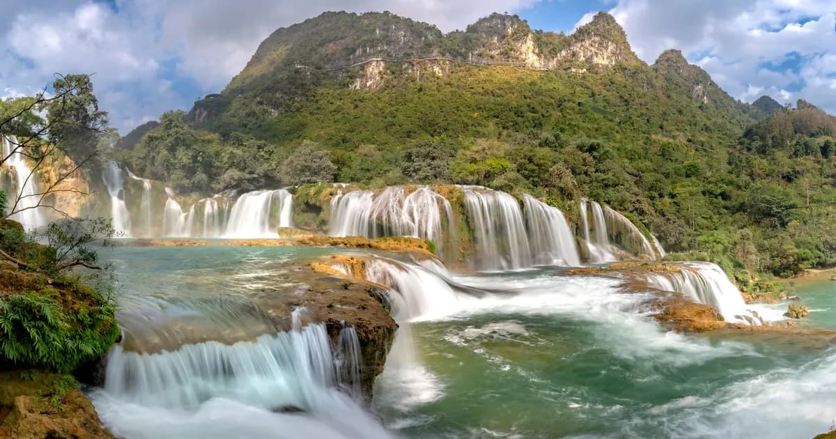
Ban Gioc is the image that draws most people north, and for once the reality matches the postcard. Thirty metres tall and around 300 metres wide, it tumbles in tiered curtains across the Quay Son River, which here forms the border between Vietnam and China. It is often called the largest waterfall in Southeast Asia, and standing before it, spray on your face, the claim feels earned.
A practical note that surprises many: no special border permit is required to visit Ban Gioc from the Vietnamese side. A valid Vietnam visa is all you need, though military checkpoints in the area may ask to see your passport, so carry it. Bamboo rafts ferry visitors close to the base of the falls for a modest fee, and the viewpoints on the Vietnamese bank are generous.
The falls are at their most thunderous in the second half of the rainy season, roughly August through October, when the Quay Son runs high and the water spreads across its full width. In the dry months the flow narrows but the setting stays beautiful, and the crowds thin considerably.
Get matched with up to 5 trusted Vietnam agencies
- Free
- No obligation
- Up to 5 agencies
Nguom Ngao Cave and Thang Hen Lake
Just three kilometres from Ban Gioc lies Nguom Ngao Cave, a 2,144-metre limestone system with three entrances and a cathedral-scale interior of stalactites and stalagmites. Lit walkways lead through chambers that took millions of years to form; it is cool, quiet and a natural counterpoint to the noise of the waterfall. Pairing the two in a single unhurried morning is one of the region's easy pleasures.
Further along the eastern route, Thang Hen Lake is a cluster of interlinked mountain lakes whose water level rises and falls with the seasons in ways local guides love to explain. On a still morning, the karst peaks double in the glassy surface. It is the kind of place that rewards sitting still.
Villages, homestays and the human landscape
The geopark is home to nine ethnic groups, chief among them the Tay, Nung, Dao, H'Mong and Lo Lo. Meeting them is not a staged performance here; it is simply the texture of daily life along the routes.
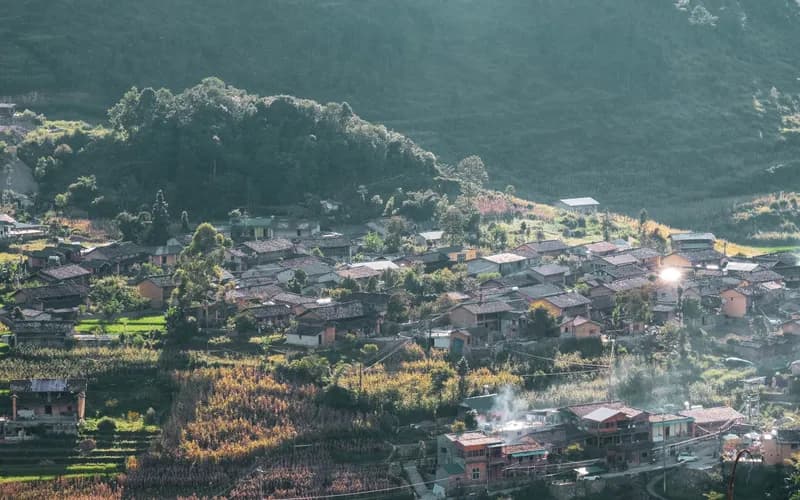
Khuoi Ky is a Tay village of houses built almost entirely from stone, wedged against a hillside near Ban Gioc. Staying in one of its homestays means meals cooked over an open fire and a genuine window into farming and weaving life. Nearby, Phia Thap is a Nung village that has made incense by hand for generations, using bamboo, cotton-tree bark and sawdust; watching the crimson bundles dry in the sun is a small, unforgettable sight.
Choosing a homestay over a hotel is the single most rewarding decision most travellers make in Cao Bang. If you want help finding operators who work directly with these communities, our partnered travel agencies can point you toward the ones doing it responsibly.
Phia Oac and the cool western highlands
The western route trades waterfalls for weather. Phia Oac-Phia Den National Park rises to 1,931 metres, high enough that in deep winter frost and even rare snow can dust the forest, while spring brings azaleas and drifting clouds. French colonists once built villas and mined tungsten here; the moss-covered ruins add a melancholy note to the cloud forest.
This is the coolest corner of the province, and a welcome change of temperature if you have spent days in the valleys. It is also the least developed of the routes, which is exactly its appeal: primeval forest, birdsong and very few other people.
When to go, and how to get there
Timing shapes the whole experience. The first two weeks of October are widely considered the sweet spot: crisp air of 20 to 28 degrees, dry roads, deep blue skies, and terraced rice fields turning a brilliant harvest gold before the lower valleys are cut. It is also, however, peak season, so book accommodation near Ban Gioc at least two weeks ahead.
Winter (December to February) is cold and misty, atmospheric in Phia Oac but chilly in the valleys. Spring brings flowers and cloud. The waterfall itself is fullest from August to October. There is no bad season, only different ones.
Getting there is part of the slowness. From Hanoi, comfortable limousine minibuses run to Cao Bang City for around 400,000 VND, taking six to eight hours; ordinary buses cost less and take a little longer. A private car with a driver (roughly 120 to 150 US dollars) makes sense for families or those who want to stop freely. Within the province, distances between sights are significant and public transport is thin, so a hired car-and-driver or a guided tour is usually the most practical way to link the routes. If you are still weighing your options for the long haul north, our guide on choosing between train, flight and sleeper bus is worth a read.
Travelling responsibly in a fragile frontier
Cao Bang is having a quiet moment, and its geopark status brings both protection and pressure. Travel here with the light footprint the landscape deserves. Spend your money with homestays and local guides rather than only at ticket gates. Ask before photographing people. Carry out your rubbish, especially on the loop roads where waste facilities are scarce. Dress modestly at Pac Bo and other historical sites.
Because this is a border region, be sensitive around checkpoints and military installations, and follow any signage about restricted photography. None of this is onerous; it is simply the etiquette of being a guest somewhere that has not yet been reshaped for mass tourism, and that is worth keeping that way. Our short primer on cultural etiquette in Vietnam covers the essentials for homestays and village visits.
What to Do Next
- Choose your window. Aim for the first half of October for golden rice and dry roads, or accept fewer crowds in the shoulder months. Lock the dates before booking transport.
- Book the journey north. Reserve a limousine minibus seat from Hanoi, or arrange a private car-and-driver if you want to stop along the way.
- Base yourself near Ban Gioc. Book a Tay homestay in or near Khuoi Ky at least two weeks ahead for October travel.
- Plan by route, not by list. Pair the eastern route (Ban Gioc, Nguom Ngao, Thang Hen) with a slow day on the western route around Phia Oac.
- Line up local guiding. Arrange a car-and-driver or a community-based guide within the province to connect the sights without rushing.
- Pack for mountains. Bring layers, rain protection in the wet months, cash for rural areas, and your passport for checkpoint areas.
Frequently Asked Questions
How many days do I need for Cao Bang?
Plan a minimum of three full days on the ground, not counting travel. Four or five lets you cover the eastern and western routes calmly, with time for a homestay stay and a slow morning at Thang Hen Lake.
Do I need a permit to visit Ban Gioc Waterfall?
No special border permit is required from the Vietnamese side; a valid Vietnam visa is enough. Carry your passport, as military checkpoints in the border area may ask to see it.
When is the best time to see Ban Gioc at full flow?
The waterfall is at its widest and most powerful in the second half of the rainy season, roughly August to October. Early October also aligns with the golden rice harvest, making it the standout window.
Can I do Cao Bang without a motorbike?
Yes. While the Cao Bang loop is popular with riders, a hired car-and-driver or a guided tour links the main sights comfortably, which suits families and travellers who prefer not to ride mountain roads.
Is Cao Bang crowded?
Far less than Sa Pa or Ha Long. It sees a rise in domestic visitors during October and at weekends near Ban Gioc, but for most of the year it remains one of northern Vietnam's quietest corners.
What are the villages worth staying in?
Khuoi Ky, a Tay stone village near Ban Gioc, is the classic homestay base. Phia Thap, a Nung incense-making village, is a rewarding daytime visit nearby.
Is Cao Bang suitable for a slow-travel trip?
It is one of the best places in Vietnam for it. The distances, the homestays and the geopark's route-based structure all reward travellers who move slowly and stay longer.