
Most people arrive in Ha Giang with a motorbike rental agreement and a four-day deadline. That is the wrong way to meet this province. The Ha Giang Loop is not a checklist of viewpoints to be conquered before sunset each day — it is a 350-kilometer unfolding of limestone spires, terraced maize fields, and Hmong, Tay, and Lo Lo villages that rewards travelers who are willing to slow the throttle down.
What the Ha Giang Loop Actually Is
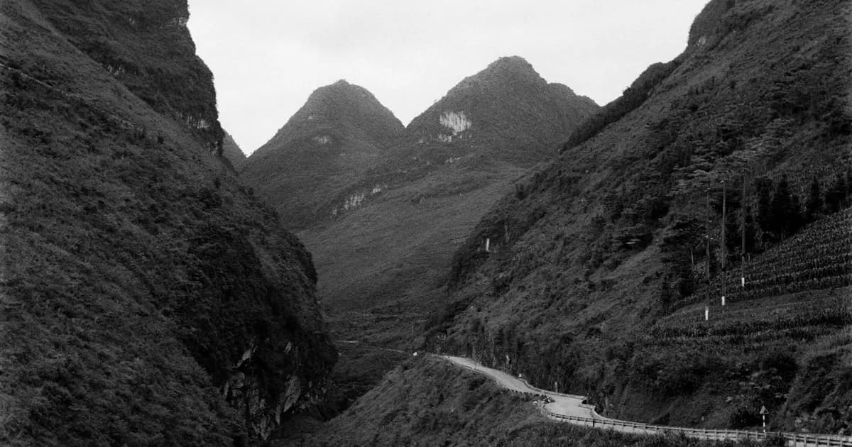
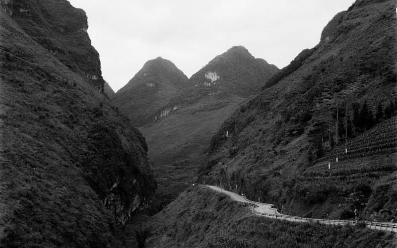
The loop threads through Vietnam's northernmost province, tracing a rough circuit from Ha Giang City through Quan Ba, Yen Minh, Dong Van, and Meo Vac before looping back through Bac Me or retracing the Ma Pi Leng Pass. Most of the province sits inside the Dong Van Karst Plateau Geopark, a UNESCO-recognized landscape of jagged grey peaks that were once a seabed, thrust skyward over millions of years and then carved by monsoon rain into the vertical, folded terrain you see today.
What separates Ha Giang from other northern loops is the sheer concentration of scenery packed into a short distance. Within a single day you pass through pine-forested valleys, the stark rock desert around Dong Van, and terraces so narrow that families still farm them by hand because no machine could manage the slope. The road itself, built and widened over decades, is one of the more remarkable pieces of infrastructure in the country: a ribbon of asphalt clinging to cliff edges with the Nho Que River running turquoise far below.
Speed is the enemy here. Riders who try to complete the loop in three days spend most of their time watching the road instead of the landscape, and they miss the two things that make Ha Giang worth the detour: the villages and the pauses.
One request. Up to five tailored proposals.
Skip contacting agencies one by one — share your trip once and let up to five trusted Vietnam agencies come to you. Free, with no obligation.
Get my free quotesThe Dong Van Karst Plateau, One Valley at a Time
Break the geopark into its component parts rather than treating it as a single blur of grey stone. The Quan Ba twin mountains, nicknamed the Fairy Bosom Mountains, mark the gateway to the highlands and are best seen early morning from the Heaven's Gate viewpoint before the tour buses arrive. Further north, the Yen Minh pine forest offers a cooler, greener contrast to the karst that follows — a good place to slow down for a night rather than pushing straight through. Travelers who enjoy this kind of terraced, valley-floor landscape often pair Ha Giang with a gentler counterpart further west, such as the rice terraces of Muong Hoa Valley near Sapa, which rewards a similarly unhurried pace.
Dong Van itself is the emotional center of the loop. The old quarter, with its century-old clay-tiled houses built by Hmong and Tay traders, still hosts a Sunday market where highland communities from surrounding villages come down to trade cattle, hemp cloth, and corn wine. A short drive away, the Lung Cu Flag Tower marks Vietnam's northernmost point on the Chinese border, and the climb up its steps is worth doing at dusk when the valley below empties of other travelers.
The Ma Pi Leng Pass, often translated as the King of the Mountain Passes, connects Dong Van to Meo Vac along a shelf of road cut directly into the cliff face above the Nho Que River canyon. A boat trip on the river itself, looking up at the pass from below, gives a very different and quieter sense of scale than the roadside viewpoints ever can.
Choosing Your Pace: Motorbike, Easy Rider, or Private Car
The loop is usually associated with self-driven motorbikes, and for confident riders with real off-road experience, a manual bike remains the most immersive way to travel it — stopping on a whim, adjusting the day's distance to the weather, pulling over for a bowl of thắng cố at a roadside stall. For 2026, most rental operators steer international riders toward semi-automatic or manual 150cc bikes rather than standard scooters, since automatic transmissions overheat on the long descents and the terrain punishes anything undersized.
That said, a self-driven motorbike is not the only — or even the best — way to experience Ha Giang slowly. Two alternatives suit different travelers:
- Easy Rider tours: a local driver takes you on the back of their motorbike, handling the technical riding while you focus entirely on the landscape and stop wherever you like. This is the option UNRUSH tends to recommend for slow travelers without serious off-road riding experience, since it removes the safety risk without removing the intimacy of two wheels.
- Private car with driver: slower on some of the narrower village roads but far more comfortable, and it allows you to bring more layers for the cold nights in Dong Van, which drop sharply even in warmer months.
Whichever mode you choose, resist the urge to match anyone else's itinerary. A four-day loop rushed is worse than a three-day loop paced with intention, and a five-day version that adds a full rest day in Dong Van or an extra homestay night in a Lo Lo Chai village will almost always be remembered more fondly than a faster one.
Get matched with up to 5 trusted Vietnam agencies
- Free
- No obligation
- Up to 5 agencies
The Border Permit and Other Practicalities
Because much of Ha Giang sits within a restricted border zone with China, every traveler needs a border-area travel permit in addition to their Vietnam visa. This is arranged locally, typically through your hotel, tour operator, or the Ha Giang tourism office, and costs a modest fee — practically all travelers get it same-day with a passport photocopy. It is not optional, and checkpoints along the loop do ask to see it, so sort it out on arrival in Ha Giang City rather than assuming a rental shop will handle it automatically.
Road conditions have improved considerably over the past several years, with wider shoulders and better surfacing on the main arteries, but the passes remain narrow, foggy in the early morning, and shared with cattle, trucks, and local families on their own bikes. Authorities have also tightened enforcement on the most dangerous curves following a rise in accidents involving inexperienced riders, including stricter checks on licenses and helmet use. None of this should discourage a careful traveler — it simply means treating the loop as a mountain road trip, not a race.
Villages, Homestays, and the Ethics of Passing Through
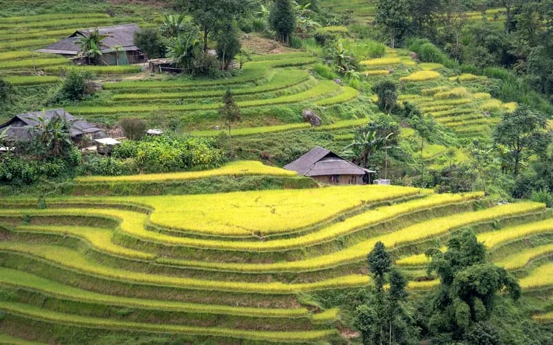
The loop passes through communities that are not tourist sets but working villages — Hmong hamlets growing corn on near-vertical slopes, Lo Lo Chai's clay houses beneath Lung Cu, and Tay stilt-house settlements along the river valleys. A homestay night in one of these villages, arranged through a local operator rather than a large tour company, does more to support the region economically than any amount of roadside shopping.
A few habits make that stay better for everyone. Ask before photographing people, particularly at markets where cattle and produce trading is business, not performance. Buy food and handicrafts directly from the people who made them rather than from intermediary shops that spring up around parking areas. And treat the region's remoteness as the point rather than an inconvenience — the appeal of Ha Giang is precisely that it has not yet been smoothed into a standardized tourist product. For a broader sense of how to behave respectfully in homestays and ethnic minority villages elsewhere in the north, UNRUSH's guide to cultural etiquette across Vietnam applies just as directly here.
When to Go and How Long to Stay
The dry season from September to November brings golden buckwheat and rice terraces around Yen Minh and clear skies over the passes, and is generally considered the single best window. March brings blooming plum and peach blossoms in the highlands. Avoid the height of summer monsoon season (June to August), when landslides and fog can close sections of road with little notice, and be prepared for genuinely cold nights in December and January, when temperatures in Dong Van can approach freezing.
Give the loop a minimum of four days, five if you can manage it. Travelers connecting from Hanoi should budget an extra day on each end for the overland journey north, since there is no airport in Ha Giang; most people arrive by sleeper bus or private transfer. If you are weighing sleeper bus against other overland options for reaching the north, UNRUSH's comparison of Vietnam's trains, flights, and sleeper buses is a useful starting point before booking.
What to Do Next
- Decide your pace first, mode of transport second — a private car or Easy Rider tour with a five-day itinerary will almost always deliver a better experience than a rushed self-driven loop.
- Book a border-area permit and your first night's accommodation in Ha Giang City before departure; everything after that can be arranged as you go.
- Choose a dry-season window (September–November or March) unless you are specifically prepared for cold or monsoon conditions.
- Pick at least one homestay night in a Hmong, Tay, or Lo Lo village and arrange it through a small local operator rather than a mass-market tour desk. UNRUSH's directory of vetted Vietnam travel agencies is a good place to compare options built around exactly this kind of slower northern itinerary.
- Pack for a genuine temperature swing — warm layers for early mornings and evenings in Dong Van, breathable clothing for the midday sun.
- If Ha Giang leaves you wanting more of Vietnam's northeastern highlands, a slower loop through Cao Bang's own karst geopark is a reasonable next stop for travelers already committed to the long journey north.
Frequently Asked Questions
Do I need a special permit to ride the Ha Giang Loop?
Yes. Because the route runs through a border zone with China, all foreign travelers need a border-area travel permit in addition to their standard Vietnam visa. It is arranged locally in Ha Giang City, usually same-day, through your accommodation or a tour operator.
Is the Ha Giang Loop safe for inexperienced riders?
Not on a self-driven motorbike. The passes involve steep grades, blind corners, and shared traffic with trucks and livestock. Travelers without genuine off-road riding experience are better served by an Easy Rider tour, where a local driver handles the bike, or by hiring a private car.
How many days should I spend on the loop?
A minimum of four days, with five recommended if your schedule allows. Rushing the loop in three days is the most common regret travelers report afterward, since it leaves no room for a slower homestay night or a rest day in Dong Van.
What is the best time of year to go?
September through November, when skies are clearest and the rice and buckwheat terraces are at their most colorful. March is a strong secondary option for blossom season. Avoid the height of summer monsoon season, when landslides can close roads.
Can I do the loop without a motorbike?
Yes. Easy Rider tours and private cars with drivers cover the same route and are often the better choice for travelers prioritizing comfort, safety, or simply the ability to look at the scenery instead of the road.
Is there an airport in Ha Giang?
No. Most travelers reach Ha Giang City by overland transfer or sleeper bus from Hanoi, a journey of roughly six to seven hours, before starting the loop itself.
What should I pack for the trip?
Layers. Mornings and evenings in Dong Van and Meo Vac can be genuinely cold, even in warmer months, while midday sun on exposed passes is intense. A light rain shell, sturdy closed shoes, and a headlamp for homestays without reliable electricity are all worth the space in your bag.