
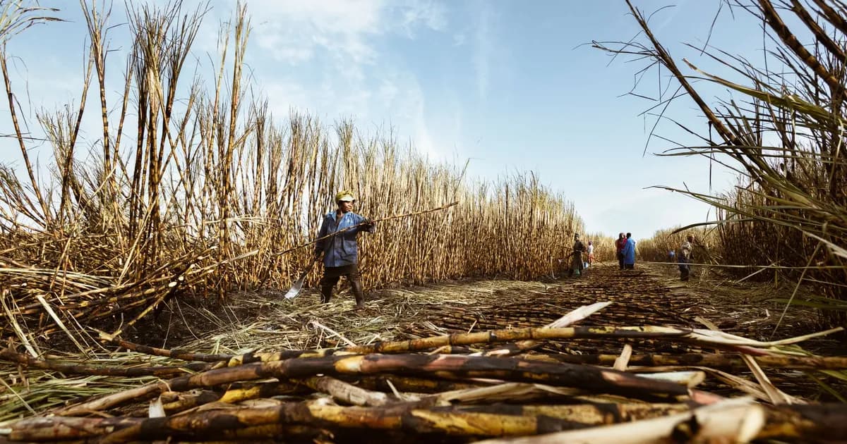
Negros Island Slowly: Sugar Country, Volcano Slopes and Quiet Coasts
Negros sits in the middle of the Visayas, big enough to hold two provinces, two languages and two very different coastlines, and yet most itineraries treat it as a corridor. It is the bus ride between Cebu and Boracay, or the ferry stop on the way to Siquijor. Stay a week and the island rearranges itself. Sugar built its towns and its inequalities. A volcano still decides what you may and may not climb. The reefs off its southern shore include one of the oldest community-run marine sanctuaries in Asia. Negros is not a highlight reel, and it does not perform for short visits. It is a place that repays patience.
Why Negros rewards a slow itinerary
Negros is the fourth-largest island in the Philippines, and its geography works against speed. A mountain spine runs down the middle, crowned by the Kanlaon massif, so there is no quick road from one side to the other. The two provincial capitals, Bacolod in the northwest and Dumaguete in the southeast, sit roughly six hours apart by Ceres bus over the Mabinay pass, with fares in the region of 410 to 510 pesos. Travellers who try to compress the island into two nights mostly see a bus window.
Slow it down and Negros becomes legible. The north and west are Hiligaynon-speaking Negros Occidental: cane fields, ancestral houses, a food culture built on chicken inasal and heirloom sweets. The southeast is Cebuano-speaking Negros Oriental, with a university town, dive villages, crater lakes and a marine sanctuary that villagers themselves fought to establish. Crossing the island means crossing a cultural border, not just a mountain range, and the crossing is worth feeling rather than sleeping through.
It also matters that Negros was never engineered for mass tourism. No single beach strip absorbs the arrivals, which means guesthouses stay small, dive operations tend to be owner-run, and your money lands closer to the people doing the work. That is the quiet argument for the island, and it is the same logic behind our guide to where to go and when in the Philippines.
One request. Up to five tailored proposals.
Skip contacting agencies one by one — share your trip once and let up to five trusted Philippines agencies come to you. Free, with no obligation.
Get my free quotesBacolod, Silay and the sugar country
Most northern arrivals land at Bacolod-Silay Airport, which sits closer to Silay than to Bacolod itself. That accident of geography is useful. Silay is one of the best-preserved colonial towns in the country, a compact grid of ancestral houses built by sugar families in the late nineteenth and early twentieth centuries, several of them now open as museums with their furniture, pianos and family photographs left roughly where they were. An afternoon walking Silay, with a stop for a pastry at one of the old bakeries, tells you more about Negros than any resort brochure.
Bacolod, half an hour south, is louder and more practical: a working city known for chicken inasal, public markets and the October MassKara Festival. Nearby Talisay holds The Ruins, the roofless shell of a mansion burned during the Second World War, which is photographed constantly and still worth an unhurried late-afternoon visit. Further out, Mambukal Mountain Resort on Kanlaon's lower slopes has hot springs, a fruit-bat colony and a chain of waterfalls.
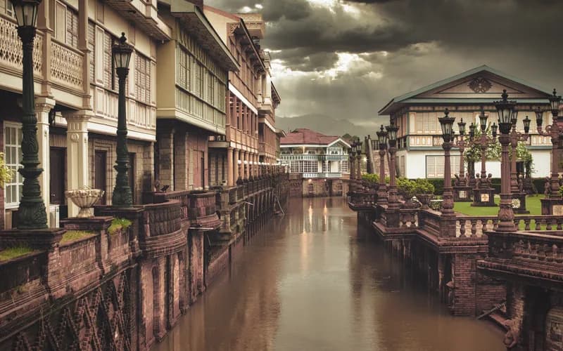
What gives the region depth is the landscape behind the monuments. The sugar cultural landscape of Negros and Panay sits on the Philippines' UNESCO tentative list, and that landscape is still working: narrow-gauge rail traces, mill towns, haciendas and the labour history that goes with them. Ask, and people will tell you both halves of the story, the elegance and the hardship. A good local guide is worth far more here than an entrance ticket.
Kanlaon: a volcano that sets the terms
Mount Kanlaon, at 2,435 metres, is the high point of the central Philippines and one of the country's most active volcanoes. In 2026 it has been restless: repeated eruptive events and a sustained Alert Level 2, with sulphur dioxide emissions spiking above 2,000 tonnes per day at times. Under Alert Level 2 the summit climb is closed and a permanent danger zone is enforced around the crater. This is not negotiable, and no guide who offers to slip you past it deserves your business.
The honest framing is this: Kanlaon is a mountain you plan around, not through. Lower-elevation destinations such as Mambukal, the Bacolod side roads and the highland town of Canlaon usually stay open, but ashfall can reach communities ten to twenty kilometres away during larger events, and farming villages on the flanks have taken real damage. Check the PHIVOLCS bulletin the morning you travel, keep a flexible day in your plan, and accept that a closed summit is not a ruined trip. If mountains are the reason you came, our notes on permits, guides and quotas on Philippine peaks will help you redirect sensibly.
Get matched with up to 5 trusted Philippines agencies
- Free
- No obligation
- Up to 5 agencies
The southwest coast: Sipalay and Danjugan
Drive south from Bacolod and the coastline empties out. Sipalay, around five hours away, is the closest thing Negros has to a beach town, and it is still a modest one: Sugar Beach and Punta Ballo hold a handful of small resorts reached partly by boat, with wrecks and reef walls offshore and very little nightlife. It rewards the traveller who books four nights rather than one.
An hour north of Sipalay, off Cauayan, lies Danjugan Island, a 43-hectare private marine and wildlife sanctuary run by a conservation foundation. Visits are structured rather than casual, which is the point. Published rates run around 950 pesos for a three-hour eco tour, about 1,950 pesos for an eight-hour day tour with meals, and roughly 2,950 pesos for an overnight stay, all including boat transfers, guiding and conservation fees. Numbers are capped, phones lose signal, and lagoons, bats and nesting birds get the run of the place. It is one of the clearest examples in the country of tourism money being routed straight into habitat protection.
Dumaguete, Dauin and Apo Island
The southeast is a different island. Dumaguete is a walkable university city with a seafront promenade, a bell tower, good coffee and enough small restaurants to keep you eating well for a week. It works better as a base than as a sight. From there, the coastal road south to Dauin strings together dive resorts facing some of the best muck diving in the Philippines, where the draw is frogfish, nudibranchs and seahorses in black volcanic sand rather than big blue drama.
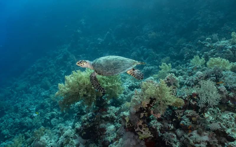
Apo Island, a short boat ride offshore, is the region's landmark. Its no-take sanctuary was established in the 1980s after years of persuasion by villagers and marine scientists, and it is still cited internationally as proof that community-managed reefs can recover. Expect green turtles at close range, strong currents on some sites and a well-run permit system: independent visitors generally pay around 300 pesos in island entrance fees plus roughly 300 pesos for the mandatory sanctuary guide, while dives arranged through Dumaguete and Dauin operators run in the region of 2,300 to 2,900 pesos each including gear and marine fees. Inland, Balinsasayao Twin Lakes Natural Park charges about 100 pesos for foreign visitors and gives you cool forest, kayaks and a morning without a boat.
Dumaguete is also the jumping-off point for the 40-minute ferry to Siquijor, which makes an easy and genuinely different companion island, as we describe in our portrait of Siquijor.
Getting around Negros without rushing
Negros is a bus and boat island. Ceres Liner runs frequent services on the Bacolod-Dumaguete route via Mabinay, and Dumaguete connects to Cebu City in about seven hours by bus and barge combinations via Tampi or the southern Cebu ports, with fares under 400 pesos. Ferries link Dumaguete with Siquijor and Bohol, Bacolod with Iloilo across the Guimaras Strait, and various northern ports with Cebu. Two airports, Bacolod-Silay and Dumaguete-Sibulan, handle flights from Manila and Cebu.
A few practical habits make the difference:
- Travel the mountain crossing in daylight; the views are the reason to take the bus rather than fly.
- Book ferry tickets online where the operator offers it, and still arrive an hour early at provincial piers.
- Budget a buffer day in the typhoon months rather than a tight connection.
- Hire a habal-habal or tricycle by the half-day in rural areas instead of per trip.
If the vehicle vocabulary is unfamiliar, our guide to jeepneys, tricycles and boats explains how the system actually works.
When to go, and what it costs
The driest, steadiest window on the Dumaguete side runs roughly from February to May, while the Bacolod side is generally at its best from December to May. October brings MassKara to Bacolod, which is genuinely good and genuinely crowded. The rainy months from June to November bring typhoon risk, and the Visayas grid has been under strain through 2026, with rotating outages affecting Negros towns and hotels running on generators. We have written separately about what the Visayas power crisis means for travellers; on Negros, plan for it rather than be surprised by it.
Costs remain modest. Simple guesthouses run from about 1,200 to 2,500 pesos a night, mid-range coastal places from 3,500 upwards, meals from 150 to 400 pesos, and the long bus crossings under 600 pesos. A two-week Negros trip is one of the better value propositions in the archipelago, particularly if you spend rather than commute.
What to Do Next
- Fix two bases, not five: one in the north around Silay or Bacolod, one in the southeast around Dumaguete or Dauin, with four or more nights each.
- Check the PHIVOLCS Kanlaon bulletin before booking anything on the volcano's flanks, and again the day before you travel there.
- Decide early whether Danjugan is part of the trip; capacity is limited and the island is booked directly through the sanctuary, not through agents.
- Book the Bacolod-Dumaguete Ceres bus for a morning departure so the Mabinay crossing happens in daylight.
- Pack a headtorch and a power bank, and confirm with your accommodation whether it has a generator.
- If you want the island's history unpacked properly, hire a Silay heritage guide and a Negros Oriental dive operator rather than a general tour package. Our vetted Philippine agencies can arrange both.
Frequently Asked Questions
Is Negros safe to visit in 2026 with Kanlaon active?
Yes, for the vast majority of the island. The alert applies to the volcano and its danger zone, not to Negros as a whole. Bacolod lies around 30 kilometres from the crater and Dumaguete is on the far side of the island; ports, airports and the main coastal roads have continued to operate normally. The practical restrictions are the closed summit trek and occasional ashfall in communities on the flanks. Check the PHIVOLCS bulletin rather than social media before you travel.
How many days do I need for Negros?
Ten to fourteen days lets you see both provinces without hurrying. A week is workable if you choose one side of the island. Anything under four nights turns into transit, because the mountain crossing alone consumes most of a day and the coastal destinations are spread along long roads.
Do I need to dive to enjoy Apo Island?
No. Snorkelling over the sanctuary is excellent and the turtles are often in shallow water near the shore. Fees still apply, and the mandatory local guide is a feature rather than an annoyance, since guides enforce the no-touch rules that made the recovery possible. Organised snorkelling day trips from Dauin that include boat, gear, lunch and permits typically cost around 4,000 pesos.
What is the best way to reach Negros?
Fly into Bacolod-Silay from Manila or Cebu for the northern half, or Dumaguete-Sibulan for the southeast. Overland and sea routes are also straightforward: buses and barges from Cebu via Tampi, ferries from Iloilo to Bacolod, and the short crossing from Siquijor to Dumaguete. Many travellers fly into one airport and out of the other, which avoids backtracking.
Are power outages a real problem for travellers?
They can be an inconvenience rather than a danger. The Visayas grid recorded dozens of yellow and red alerts through 2026, and rotating brownouts have affected parts of Negros. Most established accommodation has a generator, but air conditioning, hot water and Wi-Fi may pause for a few hours. Carry a power bank, download maps offline, and ask about backup power when you book.
Is Negros good for travellers who do not want beaches?
It is one of the better Philippine islands for exactly that. Heritage houses in Silay, the food culture of Bacolod, crater lakes and forest at Balinsasayao, waterfalls at Mambukal and the sugar landscape itself give you a full trip without spending a day on sand. The coast is there when you want it, but it is not the only reason to come.
When is the cheapest time to visit?
June to early November, outside Philippine school holidays, brings the lowest room rates and the emptiest dive boats. It is also the wettest and most typhoon-exposed part of the year. If you travel then, build flexibility into your ferry and flight bookings and treat the savings as a fair trade for occasional lost days.