

Vietnam's far southwest does not announce itself. There is no dramatic mountain pass, no famous bay, no queue at a ticket window. You cross the last braid of the Mekong and the land simply flattens into water, rice and sugar palms, with a line of low, dark hills ahead that look misplaced in a delta. This is An Giang, the province where Vietnam runs out and Cambodia begins. It has flooded forest, a Khmer upland with its own calendar, Cham Muslim villages that have woven silk on the riverbank for generations, and a border town that most itineraries treat as a lunch stop between Can Tho and Phnom Penh. Give it three or four nights instead and it becomes one of the most textured places in the country.
Where An Giang Sits Now
An Giang has changed shape. Since Vietnam's provincial reorganisation took effect on 1 July 2025, An Giang and the former Kien Giang have been merged into a single province of roughly 9,900 square kilometres and just under five million people. On paper that means the same provincial name now covers everything from the Cambodian border crossings near Chau Doc to Ha Tien, Rach Gia and Phu Quoc island. In practice, the borderland described here — Chau Doc, Tri Ton, Tinh Bien, the Bay Nui hills — is still its own world, agricultural and inland, and nothing like the resort coastline it now shares a provincial letterhead with.
The practical consequence is administrative confusion rather than travel difficulty. Older maps, guidebooks and even some booking platforms still use the pre-merger names, and bus tickets may list a district that no longer formally exists. If you are planning a route across several provinces, it is worth reading our explainer on what Vietnam's redrawn provincial map changes for travellers before you start cross-referencing addresses. On the ground, drivers and hotel staff still use the old names without hesitation.
Geographically, this is the Mekong's upstream edge inside Vietnam. The river arrives here as two great arms, the Tien and the Hau, before splintering into the delta proper further south. The Vinh Te canal, dug in the early nineteenth century, runs dead straight along the Cambodian frontier. And rising abruptly out of all that flatness are the Bay Nui, the Seven Mountains — granite outcrops that give An Giang a skyline no other delta province has.
One request. Up to five tailored proposals.
Skip contacting agencies one by one — share your trip once and let up to five trusted Vietnam agencies come to you. Free, with no obligation.
Get my free quotesChau Doc: A Border Town That Rewards Patience
Chau Doc is a working river town, not a pretty one, and that is the point. Its riverfront is a line of loading docks, fish wholesalers and floating houses tethered in the current. Its market smells of fermented fish paste, because An Giang is the national capital of mam — the pungent, salted, fermented freshwater fish that flavours much of southern Vietnamese cooking. Walk the Chau Doc central market early and you will see whole stalls of nothing but mam in tubs, sorted by fish, by cure and by price.
Most of what makes Chau Doc worth staying in is not a sight. It is the rhythm: the 5am boat traffic, the tea-and-coffee stools along Le Loi, the way the light comes off the Hau River at the end of the day. Two or three days here lets you take one short excursion each morning and spend the rest of the time simply present. That is a very different experience from the standard one-night stop, where travellers arrive at dusk, board a boat to Cambodia at seven the next morning, and see almost nothing.
Sam Mountain and the Weight of Belief
Five kilometres southwest of town, Sam Mountain rises 230 metres out of the rice. Its base and slopes are dense with pagodas, shrines and tombs, and its summit gives you the geography lesson the whole region depends on: a flat green plain, the silver lines of canals, and Cambodia beginning somewhere in the haze with no visible seam.
The reason people come is Ba Chua Xu Temple, dedicated to the Lady of the Realm, one of the most visited pilgrimage sites in southern Vietnam. Its annual festival, held from the 23rd to the 27th day of the fourth lunar month, draws enormous crowds — hundreds of thousands over the festival week — and was inscribed on UNESCO's list of Intangible Cultural Heritage of Humanity in December 2024. That listing has raised the site's profile considerably, and the festival period is now the single busiest time in Chau Doc's year.
This is a living religious site rather than a monument, and visitors are welcome but observed. Dress covered, do not photograph people at prayer, and never step over or in front of someone making an offering. If you are unsure how to behave in Vietnamese temples generally, our guide to temple, homestay and village etiquette in Vietnam covers the basics without turning them into a list of anxieties.
Get matched with up to 5 trusted Vietnam agencies
- Free
- No obligation
- Up to 5 agencies
The Cham Villages Across the Water
A short ferry crossing from Chau Doc — a few thousand dong, bicycles welcome — puts you in Chau Giang, Da Phuoc and the string of Cham Muslim villages along the eastern bank. Vietnam's Cham community here is Muslim, and the villages look and sound different from anywhere else in the delta: stilt houses raised high above flood level, small green-and-white mosques including the well-known Mubarak Mosque, women in headscarves working handlooms in the shade under the houses.
Weaving is still a real occupation rather than a demonstration, though several households now sell directly to visitors. Buy something if you like it — brocade scarves and sarongs are the standard output — but resist the urge to treat the village as a photo stop. The most rewarding version of this excursion is to rent a bicycle, take the ferry, and spend two unhurried hours riding the riverside lanes with no fixed target.
Between the banks sit the floating fish farms: houses with nets suspended beneath them, raising pangasius and tilapia. Some accept visitors and will lift the hatch to show you the churning mass of fish below. It is a fair introduction to an industry that feeds a large part of the delta's economy, and it is over in fifteen minutes.
Tra Su and the Flooded Forest
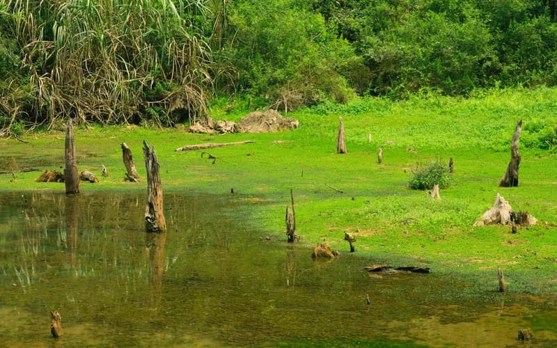
Roughly 25 to 30 kilometres from Chau Doc, about thirty-five minutes by car, Tra Su is a planted cajuput forest that spends much of the year standing in water. It is the region's signature landscape: a green ceiling of melaleuca, a floor of duckweed so bright it looks artificial, and more than seventy recorded bird species, including large colonies of storks and egrets.
Entry runs around 100,000 VND, with boat rides inside the forest typically adding 50,000 to 70,000 VND depending on the type of craft. The best sequence is the small paddle boat through the narrow duckweed channels rather than the motorised one, and the best time is early morning, before tour groups arrive from Chau Doc and Can Tho and while the birds are still active. Tra Su has been developed in recent years — there is a bamboo bridge, a viewing tower and a café — so treat it as a managed nature site rather than wilderness, and lower your expectations accordingly. It is still beautiful.
Tri Ton, Ta Pa and the Khmer Uplands
Inland from Chau Doc, the Bay Nui hills around Tri Ton and Tinh Bien are Khmer country. Khmer pagodas here have steep tiled roofs and gilded finials that belong visually to Cambodia rather than Vietnam; village life runs on a Khmer calendar with its own new year in April and its own ox-cart racing festival in autumn.
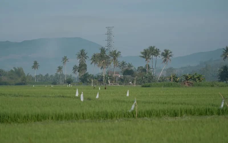
The landscape everyone photographs is Ta Pa: a patchwork of small rice plots at the foot of Ta Pa and Co To mountains, punctuated by lone sugar palms — thot not — that farmers still climb to tap for palm sugar. The fields turn gold roughly from September into November, which happens to coincide with the flood season on the plain, making autumn the single most visually rewarding time in the province. There is also a flooded quarry lake on Ta Pa hill that has become a local viewpoint.
None of this is set up for foreign visitors. There are few English signs, few guides, and almost no infrastructure beyond roadside coffee. If that appeals, An Giang belongs on the same shortlist as the places in our guide to Vietnam off the beaten path. If it does not, be honest with yourself before committing four days.
The Floating Season: When to Come
The delta has two useful seasons and An Giang exaggerates both. From roughly August to November the floodwaters come down from Cambodia, the fields fill, Tra Su is at its fullest, and the Khmer uplands turn gold. This is the classic season and the one worth planning around. From December to April the water drops, the light is clean and dry, temperatures are hot but manageable, and the landscape is more agricultural than aquatic. May to July is the hottest and least interesting stretch.
Two dates to avoid unless you specifically want them: the Ba Chua Xu festival week in the fourth lunar month, when Chau Doc is full and prices climb, and the Tet holiday, when domestic travel peaks. Pack for humidity, sun and sudden rain rather than for temperature — the practical detail is in our Vietnam packing guide for slow travellers, which covers the flooded-season problem of wet feet in some detail.
Getting There and Moving Around
Chau Doc is roughly 245 kilometres from Ho Chi Minh City, a five- to six-hour bus journey on limousine minibuses that run frequently from the western bus stations and from central pickup points. From Can Tho it is about three hours. The Chau Doc–Can Tho–Soc Trang expressway is under construction with completion targeted around 2026, and when it opens it will shorten the delta crossing significantly; until then, plan on the current road times and do not schedule a same-day connection to a flight.
River crossings to Cambodia have long operated from Chau Doc up the Bassac towards Phnom Penh, and the land border at Tinh Bien is also used by travellers. Both are subject to change, so confirm current operations and visa requirements shortly before you travel rather than relying on older accounts.
Locally, the practical options are xe om, ride-hailing in Chau Doc itself, a hired car with driver for the Tri Ton and Tra Su runs, and bicycles for the ferry-side villages. If you would rather have the logistics handled by someone who knows the province, the certified operators listed on our Vietnam travel agencies directory can build this as a private extension to a delta itinerary.
Where to Base Yourself and How Long to Stay
Chau Doc is the only sensible base. Accommodation runs from riverside mid-range hotels with balconies over the Hau to simple guesthouses in the grid behind the market; there is one long-standing colonial-era property on the waterfront for those who want it. Long Xuyen, the larger provincial city downstream, is workmanlike and less rewarding for visitors.
Three nights is the honest minimum: one for Sam Mountain and the market, one for Tra Su in the morning and the Cham villages in the afternoon, one for the Tri Ton and Ta Pa loop. Four gives you a day with nothing planned, which in An Giang is the day people tend to remember. Pairing it with a second, different delta stop makes a strong week — the coconut backwaters described in our piece on Ben Tre and the Mekong's quiet channels are a good counterweight, being greener, wetter and much less mountainous.
Eating in An Giang
The province has a distinct table. Bun ca Chau Doc is the local breakfast: snakehead fish, turmeric-yellow broth, and the specific sweetness of palm sugar behind it. Mam kho and mam chung — fermented fish braised or steamed — appear on almost every family menu and are genuinely challenging for first-timers; order a small portion and eat it with plenty of raw herbs.
Khmer influence shows up in palm sugar cakes, in the use of thot not juice as a drink, and in the beef dishes served around Sam Mountain, where the multi-course bo bay mon spread is a local speciality. Chau Doc market's food row is the easiest place to eat well cheaply, and the usual precautions about high turnover and freshly cooked plates apply as they do anywhere.
What to Do Next
- Decide your season first. If you want flooded forest and gold rice terraces, target late September to early November and build the rest of the trip around it.
- Check the lunar calendar for the fourth-month Ba Chua Xu festival and either aim for it deliberately or avoid the week entirely.
- Book three or four nights in Chau Doc rather than one. The province does not reward day-tripping.
- Arrange a car and driver for a single day covering Tri Ton, Ta Pa and the Khmer pagodas — public transport does not usefully serve that loop.
- Reserve your Tra Su visit for a weekday morning and take the paddle boat rather than the motorboat.
- Bring cash. Card acceptance thins out quickly outside Chau Doc hotels, and rural An Giang still runs on notes and QR transfers.
- If you want the logistics designed rather than improvised, start with our plan your journey page for Vietnam and set expectations about pace before anything is booked.
Frequently Asked Questions
How many days do you need in An Giang?
Three nights is the practical minimum for Chau Doc, Sam Mountain, Tra Su, the Cham villages and the Tri Ton loop. Four lets you take a day without a plan, which is usually the one that justifies the trip. One night is enough only if you are transiting to Cambodia.
Is An Giang worth visiting if I have already seen the Mekong Delta?
Yes, because it is a different delta. The classic delta circuit around Can Tho and Ben Tre is about orchards, canals and floating markets. An Giang adds mountains, a Khmer upland, a Cham Muslim community and a border frontier. If you found the standard delta tour repetitive, this is the corrective.
When is the flood season and is it a problem?
Water rises from roughly August through November. It is not a problem for travel; roads and towns stay dry and the landscape is at its best. Expect humidity, mosquitoes and afternoon rain, and pack footwear you do not mind soaking.
Can I still cross to Cambodia by boat from Chau Doc?
River services towards Phnom Penh have operated from Chau Doc for many years, and the Tinh Bien land border is also used by travellers. Schedules and operators change, so confirm directly a few days before you travel and check current visa rules for your nationality.
Is Tra Su worth the entry fee?
For most visitors, yes, particularly in flood season and early in the morning. Entry is around 100,000 VND with a small additional charge for the boat. Be aware that it is a developed, managed site with bridges, a tower and a café rather than untouched wetland.
Do people speak English in Chau Doc?
Rarely, outside hotel reception desks and a handful of tour operators. This is one of the reasons to slow down here: a translation app, a written list of destinations in Vietnamese, and patience will serve you better than assuming you can improvise in English.
What is the province called now after the merger?
It is all An Giang. Since 1 July 2025 the former Kien Giang province, including Rach Gia, Ha Tien and Phu Quoc, has been merged into An Giang. The borderland around Chau Doc keeps its character, but expect older maps and listings to use the previous provincial names for some time yet.