Phu Yen and Tuy Hoa: The Quiet Coast of the New Dak Lak
Phu Yen was never on the standard Vietnam circuit, and for a long time that was precisely its appeal. The people who came did so because someone had told them about a stretch of south-central coast between Quy Nhon and Nha Trang where the fishing villages still fished, the beaches had no loungers, and a set of hexagonal basalt columns stepped down into the sea like a badly stacked woodpile. None of that has changed. What has changed is the address. Since the middle of 2025, Phu Yen no longer exists as a province: its coastline, its lagoons and its unhurried capital, Tuy Hoa, now belong to an enlarged Dak Lak that runs from the Cambodian border all the way to the East Sea. For anyone who travels slowly, that administrative reshuffle turns out to be quietly useful.
Where Phu Yen Actually Is, and Why Its Address Changed
Geographically, nothing moved. The coast still sits roughly halfway between Da Nang and Ho Chi Minh City, with close to 190 kilometres of shoreline folded into bays, rocky headlands and brackish lagoons. Tuy Hoa still stands where the Da Rang river meets the sea, backed by low hills that turn gold in the late afternoon.
What changed is the map. On 1 July 2025 Vietnam's nationwide provincial merger took effect, and Phu Yen was joined to Dak Lak. The resulting province covers a little over 18,000 square kilometres, holds more than 3.3 million people, and borders Gia Lai, Khanh Hoa, Lam Dong, Cambodia and the sea. In one stroke, a landlocked coffee province acquired a coastline, and a quiet coastal province acquired a highland hinterland.
This matters for planning in two practical ways. First, the signage, official listings and increasingly the addresses you meet on the ground say Dak Lak, not Phu Yen, which is disorienting when your own booking confirmation still says otherwise. Keep both names in your notes and search with both. Second, the two halves are now promoted and funded as a single unit, with National Highway 29 as the spine between the Tuy Hoa beaches and the coffee plateau around Buon Ma Thuot. If you have been looking for a way to link sea and highland without taking an internal flight, this is now one of the most natural corridors in the country. Our explainer on what the new provincial map changes for travellers covers the wider reshuffle.
One request. Up to five tailored proposals.
Skip contacting agencies one by one — share your trip once and let up to five trusted Vietnam agencies come to you. Free, with no obligation.
Get my free quotesTuy Hoa: A Provincial Capital That Never Learned to Hustle
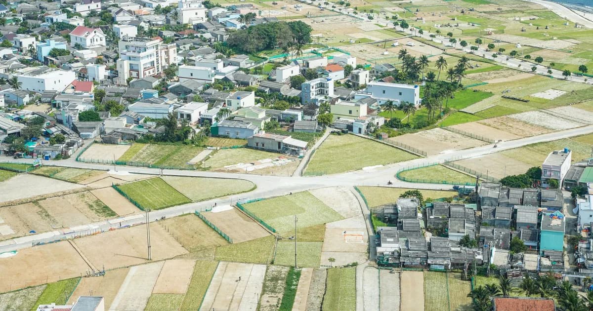
Tuy Hoa is not a beautiful city, and it is more honest to say so than to dress it up. It is a grid of low buildings and wide boulevards built for more traffic than ever arrives, fronted by a municipal beach that runs for kilometres with almost nobody on it. There is a hilltop Cham tower, Thap Nhan, lit at night above the river. There is a modern seafront landmark, the Nghinh Phong tower, where local families gather at dusk. Beyond that, there is very little in the way of sights.
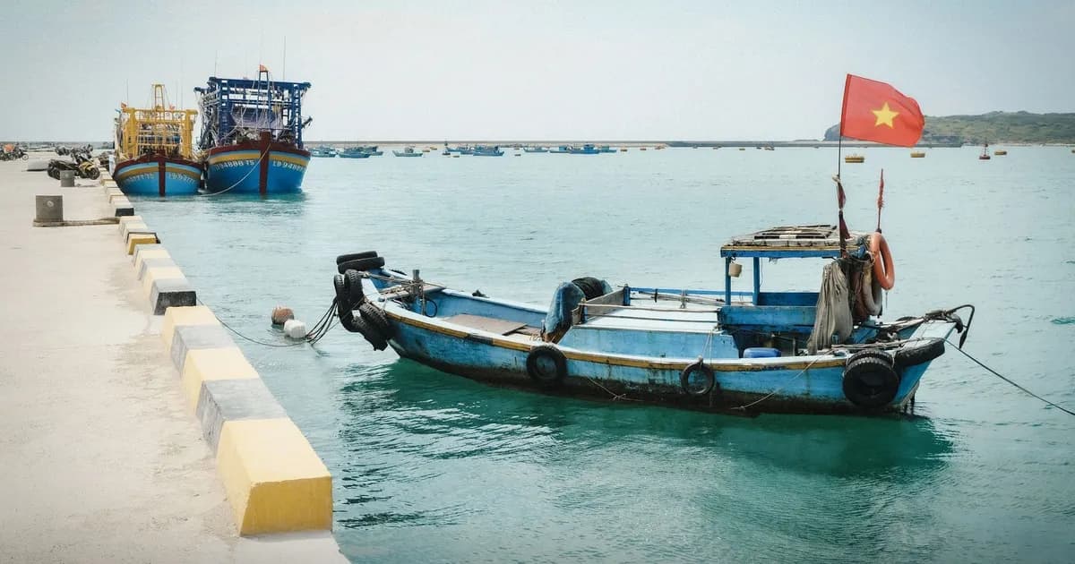
What Tuy Hoa has instead is texture. Nobody tries to sell you anything. Coffee costs what coffee costs. The morning market near the river mouth is a working market rather than a photographed one, and the boats coming in are tuna boats, because this is a genuine ocean-fishing port rather than a resort town that keeps a few hulls around for atmosphere. If you have spent a fortnight being quoted visitor prices further north, the first hour in Tuy Hoa functions as a decompression chamber.
Treat it as a base rather than a destination. Three or four nights here, with a motorbike or a car and driver, puts everything below within reach without repacking once.
The Coast in Three Movements
The shoreline divides naturally into three days of travel, and doing them as three separate outings rather than one long loop is the difference between seeing the coast and driving past it.
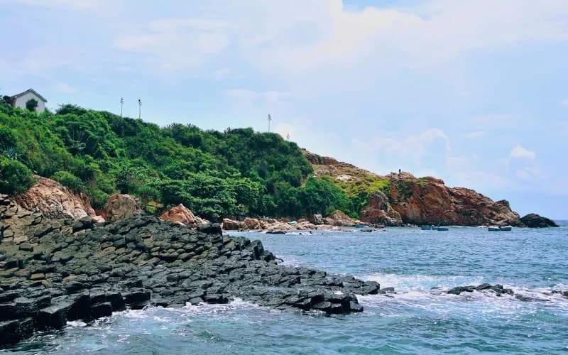
North of the city, a slow road threads past Long Thuy village, the fish-sauce hamlets and Hon Yen, where a reef surfaces at the lowest tides. Further on comes Ganh Da Dia, the basalt formation that made the province briefly famous: thousands of dark, roughly hexagonal columns packed together at the waterline, formed as ancient lava cooled and cracked. It photographs better than it reads, and it is small, so go early and give it twenty unhurried minutes rather than an hour of queueing for the same rock.
Closer to town, Bai Xep is the crescent of sand and boulders that appeared in a much-loved 2015 Vietnamese film and has been quietly busy ever since. It is still lovely, and it now has a handful of small places to sleep. Expect Vietnamese weekend visitors rather than foreign crowds.
South of Tuy Hoa the road climbs over a pass towards Vung Ro bay and Mui Dien, also called Dai Lanh, where a French-era lighthouse stands on a headland above the little beach of Bai Mon. Mui Dien is long promoted as the first point on the Vietnamese mainland to catch the sunrise, a claim contested by a neighbouring cape; either way, the walk up in the dark and the light coming off the water are worth the alarm clock. If this stretch appeals, the comparable but slightly livelier coast just north is covered in our piece on Quy Nhon and its quiet shoreline.
Get matched with up to 5 trusted Vietnam agencies
- Free
- No obligation
- Up to 5 agencies
O Loan Lagoon and the Slow Inland Detours
Inland, the landscape softens. O Loan is a shallow brackish lagoon ringed by low hills, best seen from the old bridge at first light when the fish traps and coracles are being worked. It is also the place to eat blood cockles, which are a local point of pride and, like all shellfish, worth ordering where the turnover is fast.
Nearby, Mang Lang is a small nineteenth-century church in an unexpectedly Gothic key, tied into the early history of written Vietnamese and quietly proud of it. The visit takes half an hour. What makes the detour worthwhile is the countryside between the stops: sugarcane, rice, duck flocks, cattle on the verge, and the ordinary rural rhythm that the coastal resorts have no interest in showing you. Travellers curious about staying inside that rhythm rather than driving through it should read our analysis of Vietnam's shift towards farm stays and rural tourism.
What There Is to Eat
The food here is coastal, brothy and unfussy, and it is one of the strongest reasons to linger.
- Banh canh cha ca, a thick noodle soup with fish cake, eaten for breakfast in tin-roofed shops that open at five and sell out by nine.
- Cha bo, a dense beef sausage cured with pepper, sold in rounds from roadside stalls and excellent with cold beer.
- Sea urchin and blood cockles around the lagoons, grilled simply and priced by the plate.
- Tuna, in every possible form, including the local speciality that involves the eye of the fish served in a clay pot. It is not a dare; it is a texture. Order it once and decide.
Two habits will improve every meal: eat at the hour locals eat, and choose the stall with the shortest menu. If you want the wider picture before you arrive, our guide to Vietnamese food sets out how regional cooking differs along the length of the country.
Getting There and Moving Around
Tuy Hoa has a small airport with daily connections to Hanoi and Ho Chi Minh City, and the flight is often the cheapest way in. The airport sits close to town, so transfers are short and cheap.

The better arrival, if your schedule allows, is the train. The north-south line stops at Tuy Hoa, which means you can arrive from Da Nang, Quy Nhon or Nha Trang without setting foot in an airport, and the section hugging the coast south of the city is among the more attractive stretches of Vietnamese rail. Book a soft sleeper, accept that the timetable is approximate, and treat the journey as part of the trip.
By road, National Highway 1 runs through, and National Highway 29 climbs west towards Buon Ma Thuot in roughly half a day of steady driving. That road is the practical reason to combine this coast with the coffee highlands around Buon Ma Thuot into a single unhurried loop rather than two separate trips.
Locally, a rented scooter is the standard solution and the roads are mild by Vietnamese standards, though the coastal passes reward caution and a proper helmet. A car with driver for a full day is the sensible alternative in the rain or with luggage.
When to Come, and When Not To
This is a dry-season coast. Broadly, the reliable window runs from late winter through the spring and into the summer, with February to May offering the most settled combination of calm sea and manageable heat. Midsummer is hot and bright; the sea is at its best and the inland detours are punishing at midday.
From roughly September into December the pattern reverses. The south-central coast takes rain and the tail end of the typhoon season, boat trips get cancelled, and the lagoons turn the colour of weak tea. Travel is still possible and prices fall sharply, but build slack into the itinerary and do not plan a single-day dash to Ganh Da Dia in November. Because Vietnam has several distinct climate zones running simultaneously, it pays to check the national picture before fixing dates; our plan your journey page is the place to start.
Where to Stay, Honestly
The accommodation here is thinner than the scenery deserves, and that is part of the appeal and part of the frustration.
In Tuy Hoa itself, expect comfortable, characterless city hotels at modest prices, plus a growing number of larger beachfront properties aimed at the domestic market. Around Bai Xep and Long Thuy there is a scattering of small guesthouses and one or two design-minded places with a dozen rooms. Around the lagoons and towards Vung Ro, options thin out to family-run rooms and the occasional homestay, often unlisted on international platforms and easier to arrange by phone or through a local operator.
Two practical notes. Weekends and Vietnamese public holidays fill the best small places months ahead, because this coast is a domestic favourite. And if you want the inland detours arranged properly, with a driver who knows which lagoon road is passable, working with a local specialist is worth the margin; our directory of vetted agencies is a starting point.
The Case for Four Nights Instead of Two
Most itineraries that include this coast give it a single night, treating Tuy Hoa as a refuelling stop between Hoi An and Nha Trang. That is enough time to photograph the basalt columns and nothing else.
Four nights changes the trip. You get one slow day north, one slow day south, one day inland to the lagoon and the countryside, and one day with nothing planned, which on this coast is when the good things happen: the tuna auction you were not looking for, the family who insists you sit down, the pass you drive twice because the light changed. The province was always built for that kind of travel. Now that it shares a provincial border with the coffee highlands, it is also the missing link in an itinerary that goes from the sea to 500 metres of red basalt soil without a boarding pass.
What to Do Next
- Decide your season first. Aim for the February-to-May window unless you are content to trade weather for empty beaches and lower prices.
- Choose your arrival. Fly into Tuy Hoa for speed, or take the north-south train from Da Nang, Quy Nhon or Nha Trang for the better journey.
- Book four nights in one base, ideally split between a Tuy Hoa city hotel and two nights near Bai Xep, rather than moving every night.
- Reserve small coastal guesthouses well ahead if your dates fall on a weekend or a Vietnamese public holiday.
- Arrange transport locally: a scooter for the flat coastal runs, a car and driver for the passes, the lagoon roads or any day with rain in the forecast.
- Pair the coast with the highlands. Allow half a day on National Highway 29 to Buon Ma Thuot and give the plateau at least three nights of its own.
- Search under both names. Keep "Phu Yen" and "Dak Lak" in your queries when hunting for accommodation, transport or opening hours.
Frequently Asked Questions
Is Phu Yen still a province?
No. Since 1 July 2025 the former Phu Yen has been part of an enlarged Dak Lak province, which now stretches from the Cambodian border to the coast. The place names on the ground, including Tuy Hoa, Ganh Da Dia and O Loan, are unchanged, and locals still say Phu Yen in conversation. Only the provincial address has changed.
How many days should I give this coast?
Three nights is the practical minimum and four is better. That allows one day north towards Ganh Da Dia, one day south towards Mui Dien and Vung Ro, one inland day around O Loan, and a day held in reserve. A single overnight stop reduces the province to one photograph.
Is it better than Quy Nhon or Nha Trang?
It is quieter than both, with less infrastructure and fewer English-speaking services. Quy Nhon has more restaurants and a livelier beachfront; Nha Trang has an international airport and resorts at every price point. Choose this coast if emptiness matters more to you than convenience.
Can I get here without flying?
Yes. Tuy Hoa is a scheduled stop on the north-south railway, so you can arrive by sleeper train from Da Nang, Quy Nhon, Nha Trang or Ho Chi Minh City. Long-distance buses also run along National Highway 1. The train is slower than the bus timetable suggests but considerably more comfortable.
What is the weather like in October and November?
Wet. The south-central coast takes the bulk of its rain and the tail of the typhoon season in the last months of the year. Boat trips and island hops are frequently cancelled, and the sea is rough. Prices are low and the landscape is green, so it is not a write-off, but it is not the time for a tight schedule.
Is the coast suitable for swimming?
Generally yes, during the dry season. The long municipal beach at Tuy Hoa has an open shoreline with few facilities and no lifeguards to rely on, so judge the surf yourself. The sheltered pockets at Bai Xep, Bai Mon and Long Thuy are calmer and better for a long swim.
How do I combine this with the Central Highlands?
Drive National Highway 29 west from Tuy Hoa towards Buon Ma Thuot. It takes most of a morning with stops and climbs steadily from sea level onto the plateau. Doing it in that direction, from coast to highland, gives you the more gradual change in climate and the better light.